|
|
Walk 57 - Branstree - 2nd August 2021 |
||||
Wainwright's Walking Guide to the Lake District Fells - Book 2 The Far Eastern Fells |
||||
#135 Tarn Crag
2178 ft |
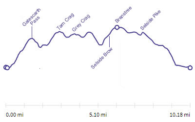 |
Distance |
10.2 miles |
|
Time |
8 hrs |
|||
Lowest Point |
799 ft |
|||
Highest Point |
2339 ft |
|||
Total Ascent |
3213 ft |
|||
Walk Rating - tough mainly due to length |
||||
 |
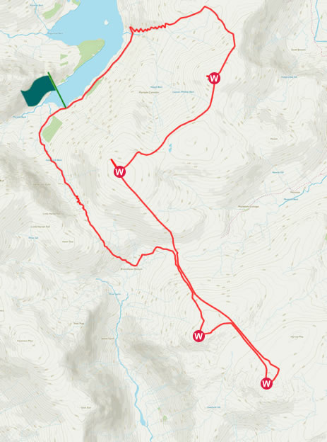
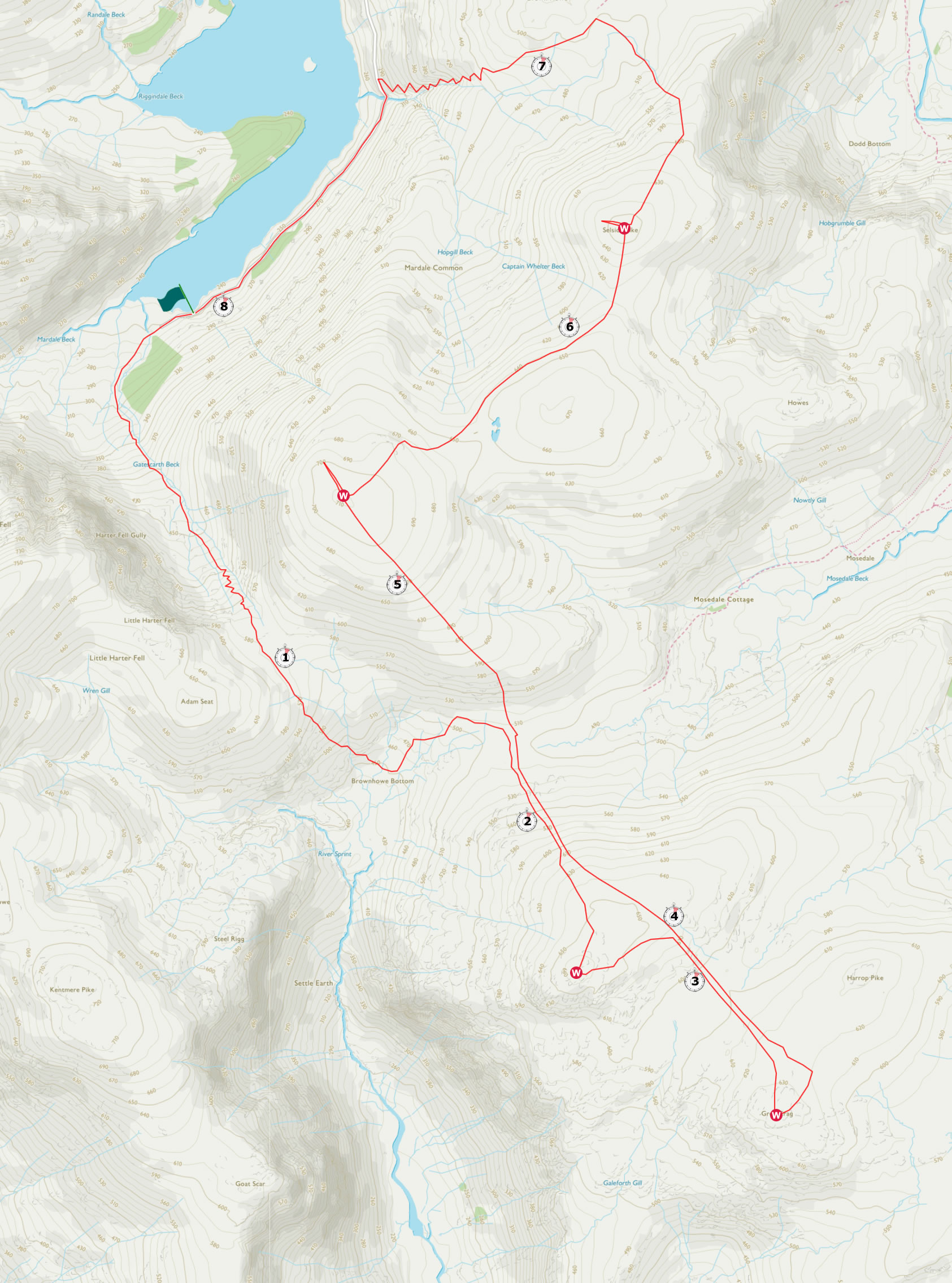
Mini Route Map Go to walk start
|
 |
|---|
 |
||
|---|---|---|
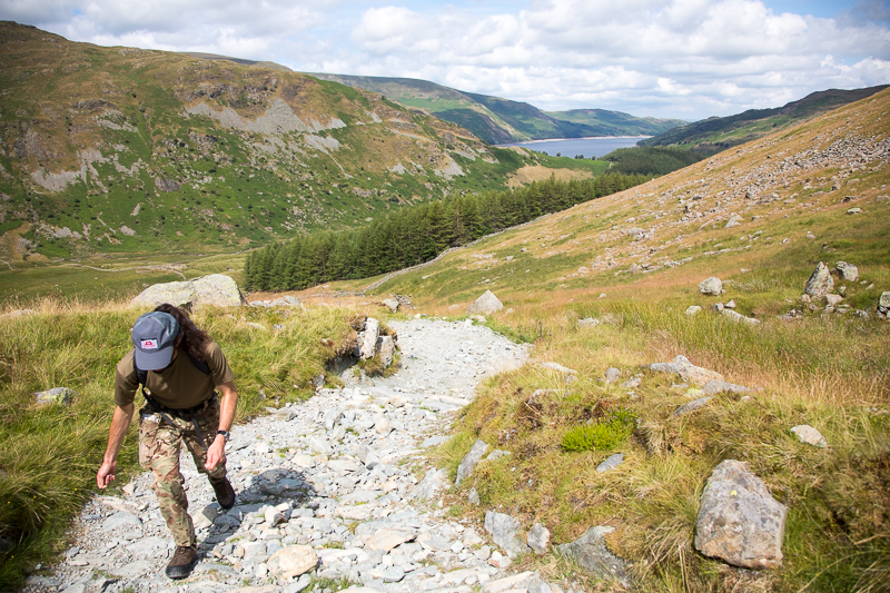
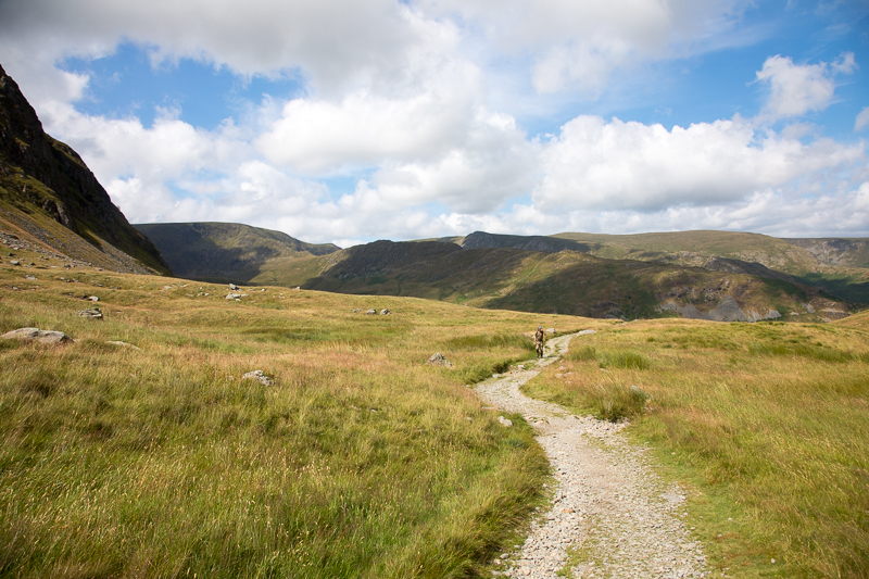
| 13.37 Walking up the path from Mardale Head at the end of Haweswater. |
 |
||
|---|---|---|
| 13.55 Gatescarth pass between Branstree and Harter Fell. The path levels off for a bit half way up before a steeper final section. |
 |
||
|---|---|---|
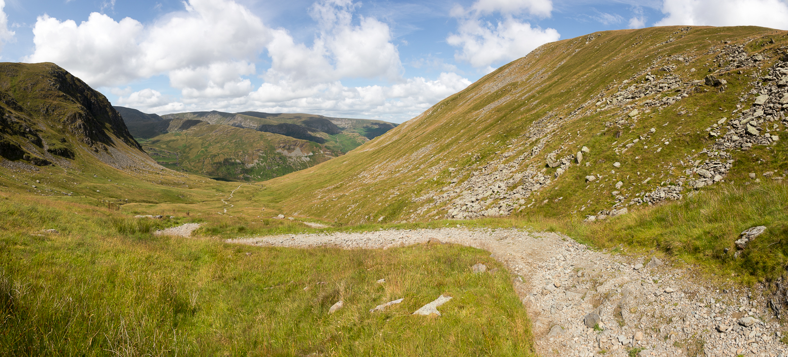
| 14.12 Panorama 526 Nearing the ridge at the top of Gatescarth Pass. |
 |
||
|---|---|---|
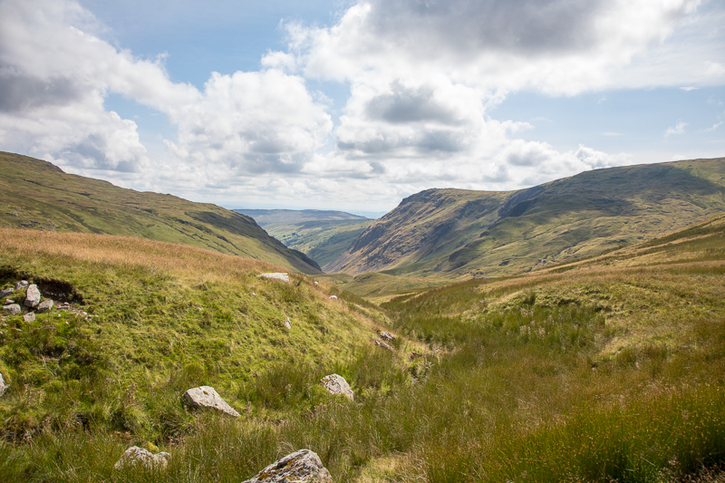
| 14.31 On the other side of the pass the path drops down quite a way before joining the route to Tarn Crag so we decided to cut off this corner and walk across the fell below Branstree using sheep tracks in places. We saved a little distance but probably not much time. This is the view looking south towards Goat Scar. |
 |
||
|---|---|---|
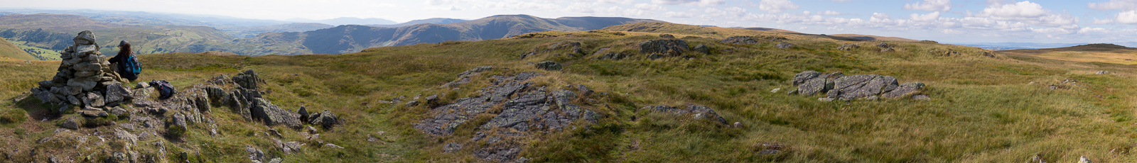
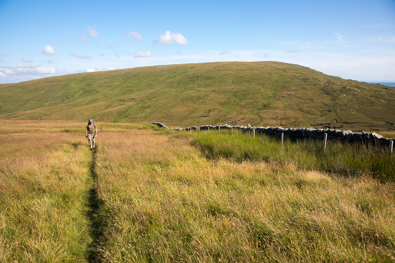
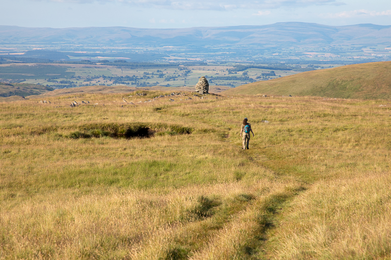
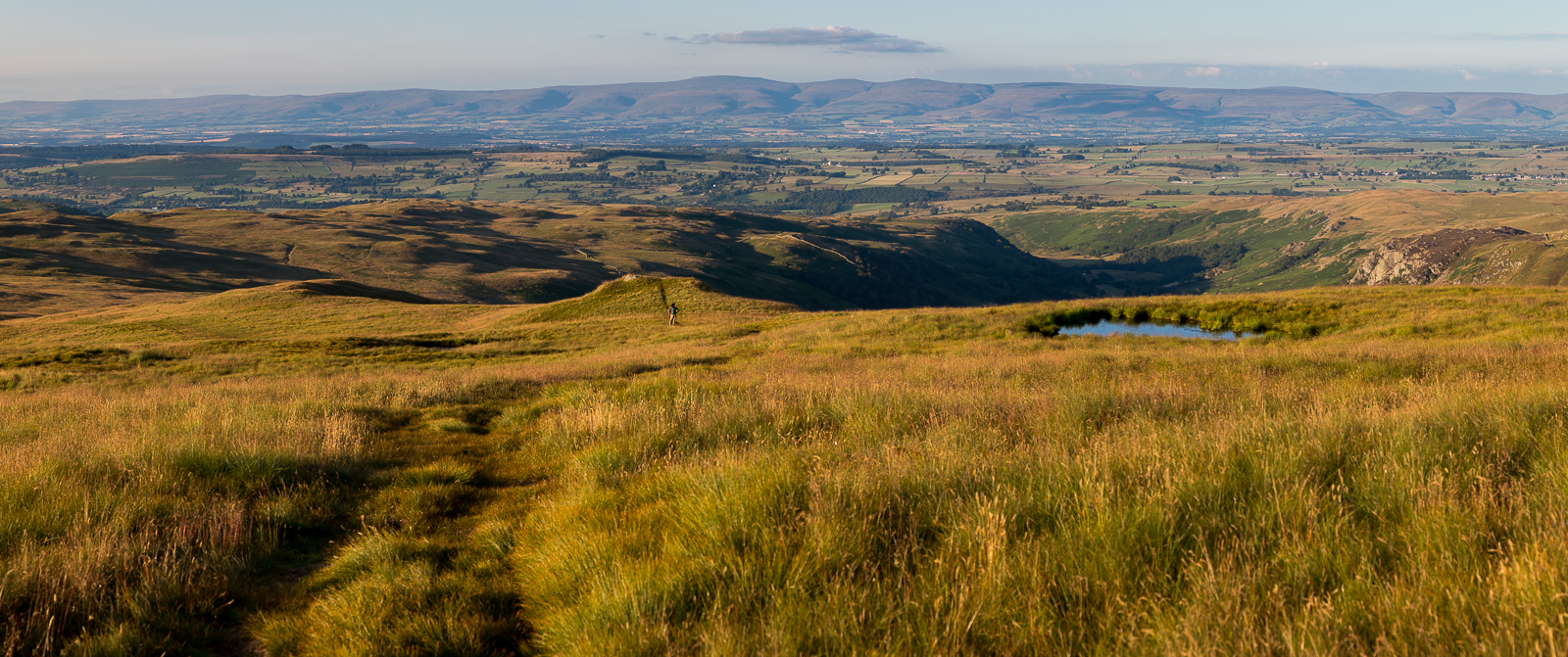
| 15.44 Panorama 527 Tarn Crag with its distinctive structure near the summit. |
 |
||
|---|---|---|
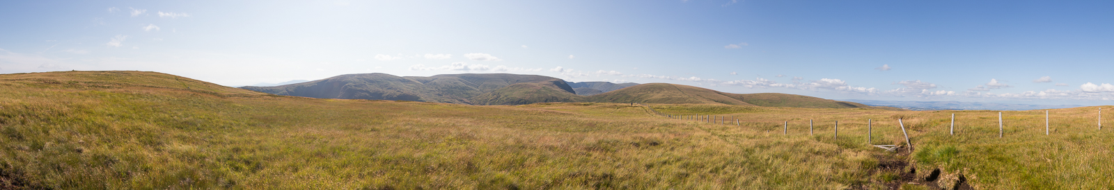
| 16.39 Panorama 528 An hour later and we have negotiated the boggy area between the two summits by following Wainwright's suggestion of sticking close to the fence, and have reached the summit of Grey Crag. |
 |
||
|---|---|---|
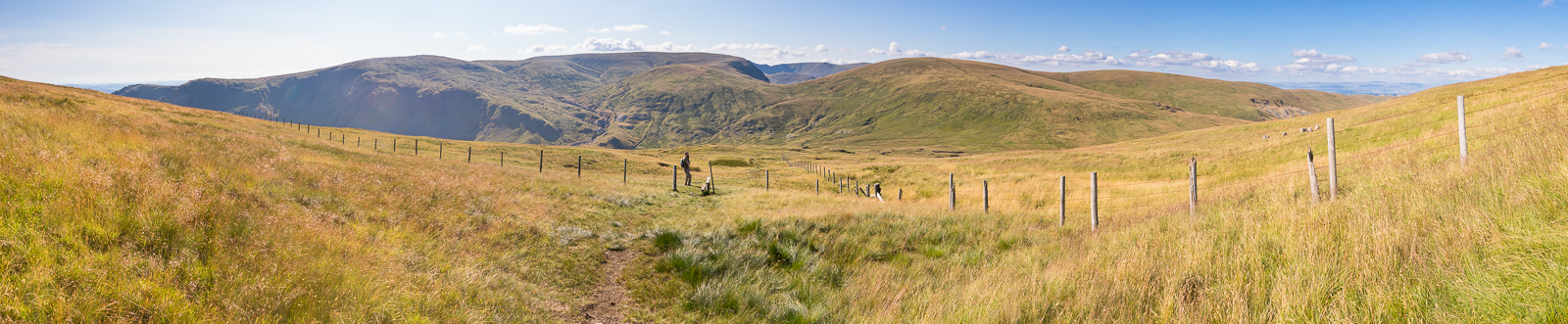
| 17.23 Panorama 529 A series of ups and downs made this a fairly punishing day. Walking down the side of Tarn Crag with our next target and the steepest stretch ahead up the back of Branstree.. |
 |
||
|---|---|---|
| 17.27 |
 |
||
|---|---|---|
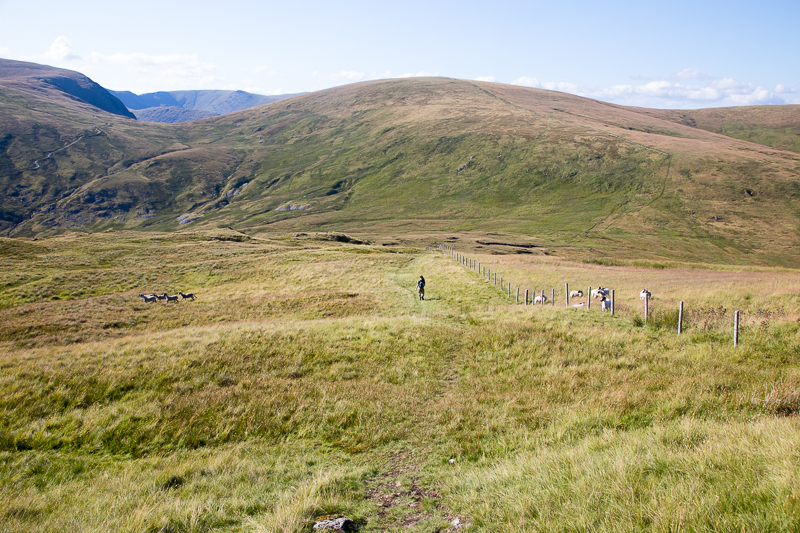
| 17.30 Scaring the sheep |
 |
||
|---|---|---|
| 18.03 The first stretch up Branstree was soul destroying. Every few minutes it cranked up another few degrees as though in a deliberate attempt to break your spirit. However it then turned the corner of the wall and reduced to a much more gentle ascent. |
 |
||
|---|---|---|
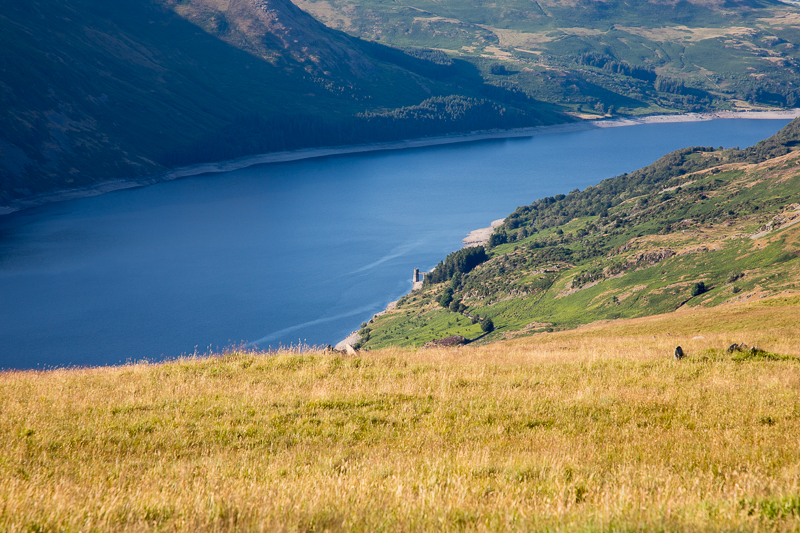
| 18.37 Looking down from Branstree to the tower on the side of Haweswater. |
 |
||
|---|---|---|
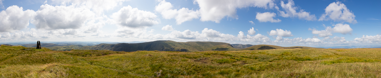
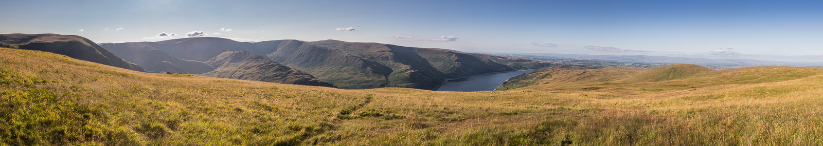
| 18.39 Panorama 530 Branstree summit was our highest point on this trip at 2339 ft. This Panorama was taken about 100m to the west for a better view of the valley below. |
 |
||
|---|---|---|
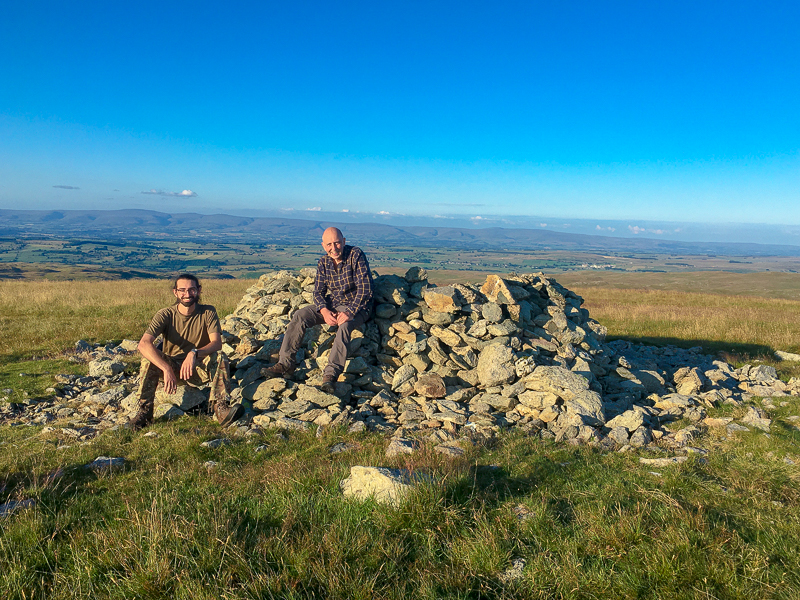
| 18.45 Branstree summit stone. |
 |
||
|---|---|---|
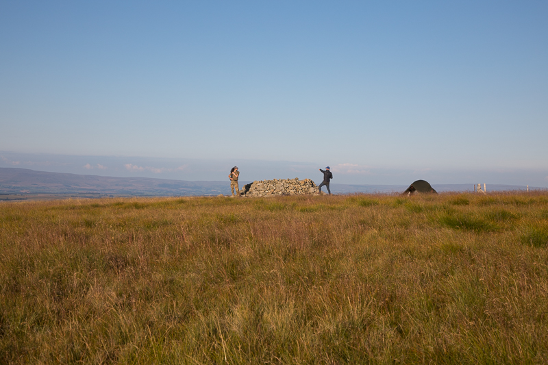
| 18.47 We decided to walk down to this cairn for the snack as there is nowhere to sit and not much view at the actual summit. |
 |
||
|---|---|---|
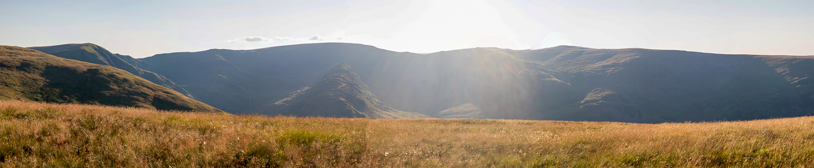
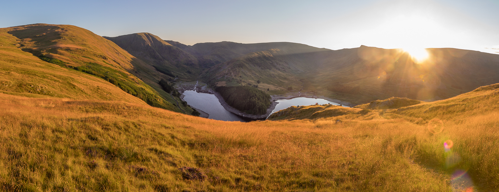
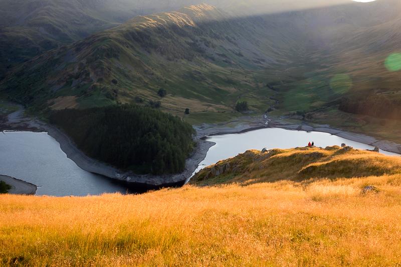
| 19.38 Panorama 531 Selside Pike was the last summit of the day where we met a guy wild camping on the top. Again a walk slightly away from the summit was needed to get a view downwards. The bright evening sun made this photo difficult to take and process but Small Water and Blea Water are just visible at the top of Mardale. |
 |
||
|---|---|---|
| 19.38 A man from the north east pointing things out to Nick. |
 |
||
|---|---|---|
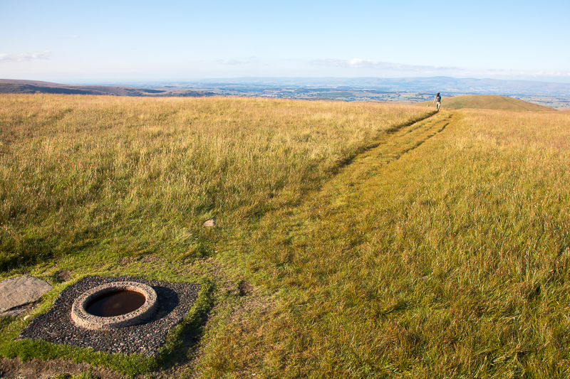
| 19.40 Selside Pike summit. |
 |
||
|---|---|---|
| 19.50 A gentle walk down to meet the old corpse road that runs between Shap and Mardale. |
 |
||
|---|---|---|
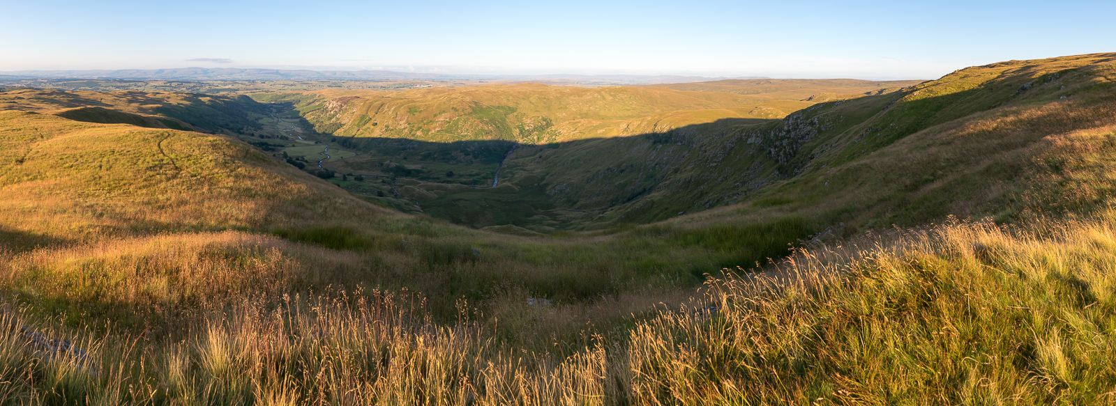
| 19.53 Panorama 532 Looking down into Swindale from High Blake Dodd. |
 |
||
|---|---|---|
| 20.21 Panorama 533 We soon reached the point on the old corpse road where it starts to descend towards Mardale. |
 |
||
|---|---|---|
| 20.22 A nice spot for a wild camp. |
 |
||
|---|---|---|
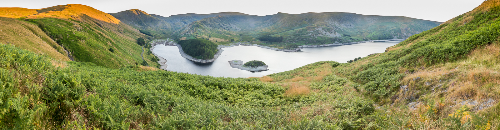
| 20.30 Panorama 534 The level in Haweswater was well down giving the island of Wood Howe the shape of a snail. Our car is visible at the end of the road but still a mile and a half to walk. |
 |
||
|---|---|---|
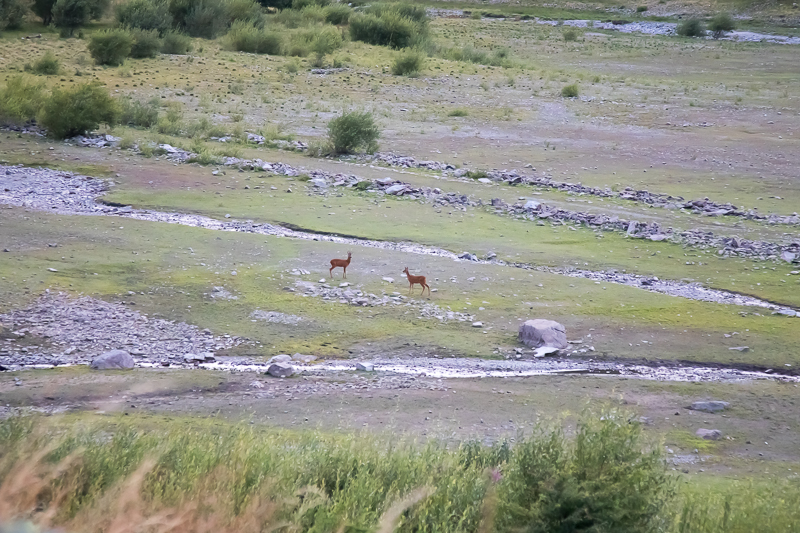
| 21.10 As we near the car we spotted these guys out for an evening graze in an area that is often submerged. |
|
|
 |
|---|