|
|
Ben Nevis - 4th September 2021 |
||||
|
||||
Ben Nevis 4413 ft |
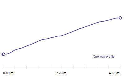 |
Distance |
10 miles |
|
Time |
7.5 hrs |
|||
Lowest Point |
46 ft |
|||
Highest Point |
4413 ft |
|||
Total Ascent |
4853 ft |
|||
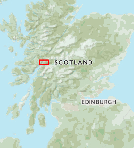 |
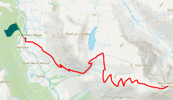
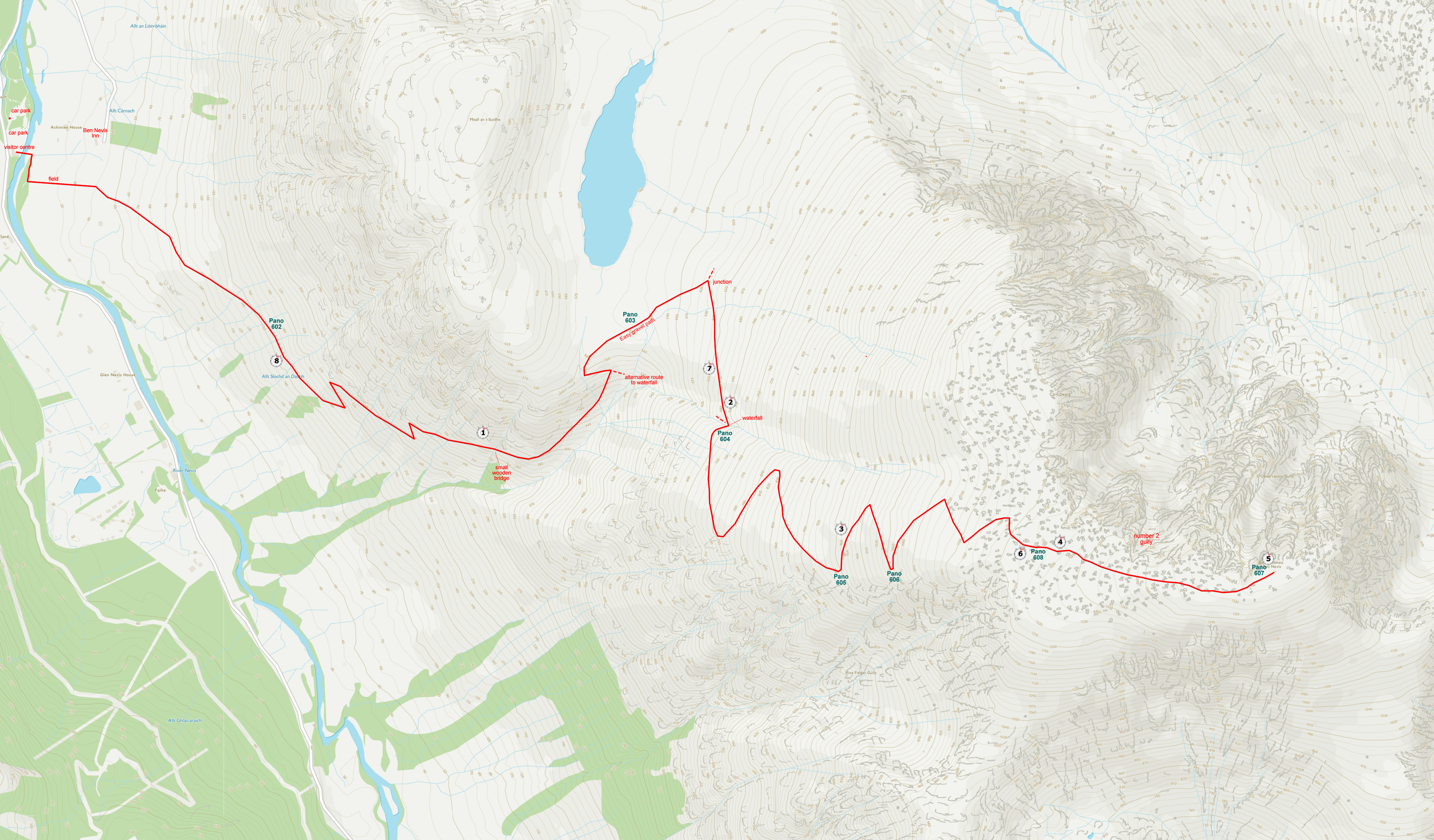
Mini Route Map Go to walk start
|
 |
|---|
 |
||
|---|---|---|
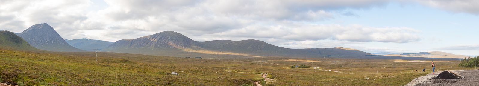
| 13.25 Panorama 601 The day before the Ben Nevis walk we drove up from Cumbria. This is a coffee stop at Glen Coe. Feeling fairly tired after a string of continuous walking days, we were looking forward to a rest day on the Saturday and then to walk up Ben Nevis on the Sunday. However during the evening we read the weather forecast which was showing much poorer weather on the Sunday so we had to make a sudden switch and bring the walk forward. |
 |
||
|---|---|---|
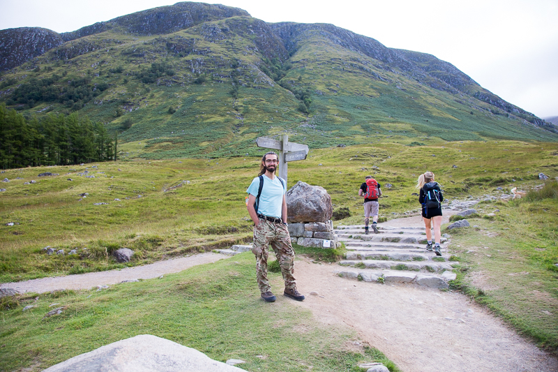
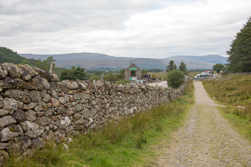
| 10.19 At the start of the path having just crossed over from the visitor centre. |
 |
||
|---|---|---|
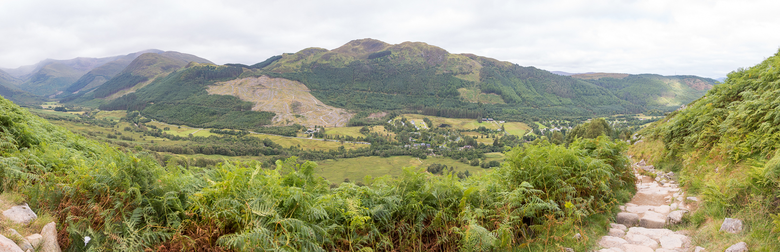
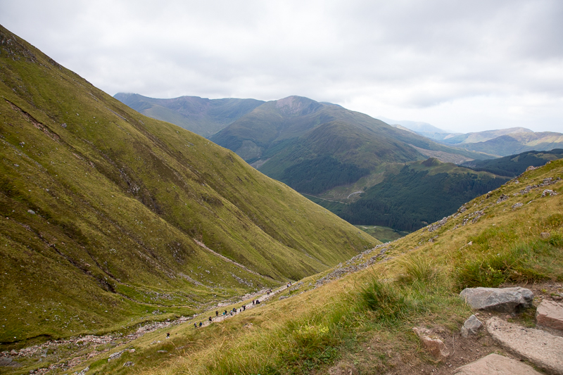
| 10.41 Panorama 602 Looking back over the valley from the first part of the walk. |
 |
||
|---|---|---|
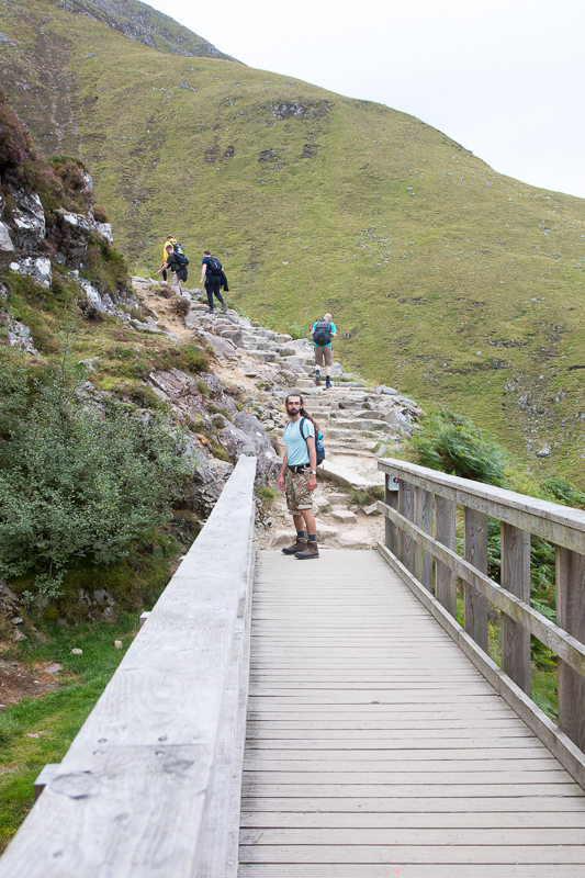
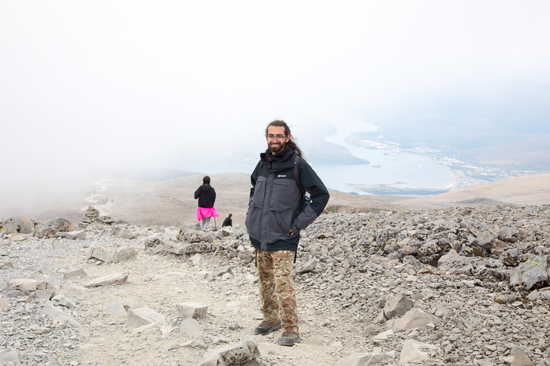
11.05 Just past this bridge the path curves around the southern end of Meall an t-Suidhe and climbs up with Red Burn. |
 |
||
|---|---|---|
| 11.15 |
 |
||
|---|---|---|
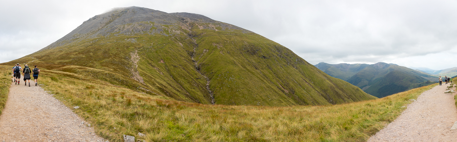
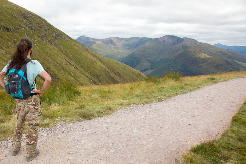
| 11.33 We have turned the corner and are on the short leg |
 |
||
|---|---|---|
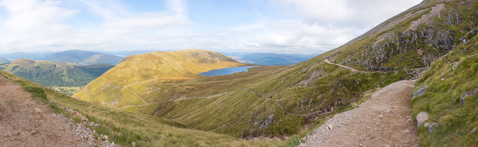
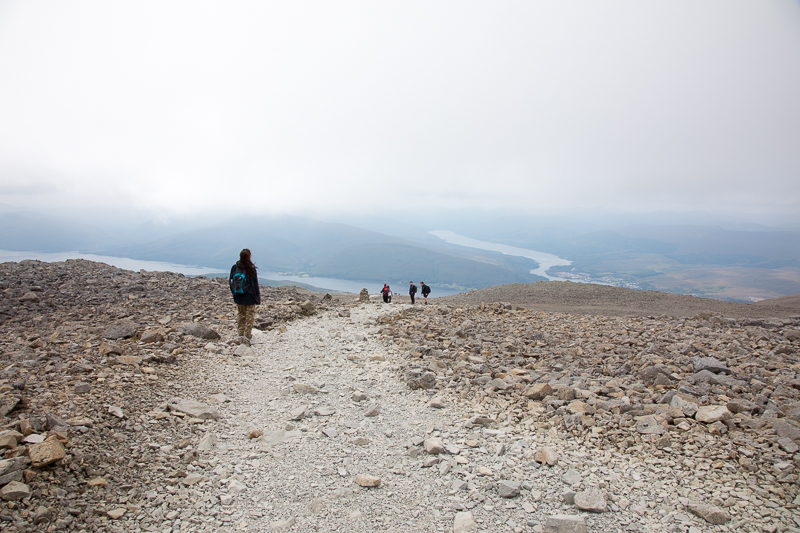
| 11.40 Panorama 603 On the long gentle gravel path near the lake. |
 |
||
|---|---|---|
| 12.05 The waterfall was quite dry today. |
 |
||
|---|---|---|
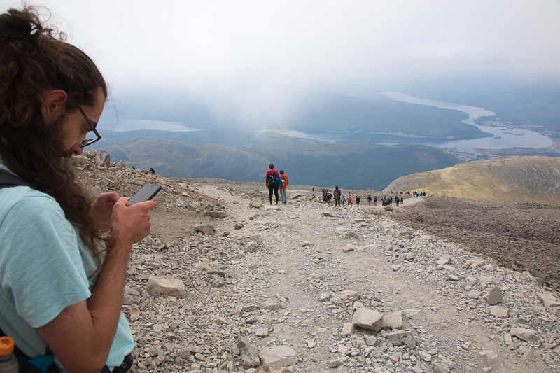
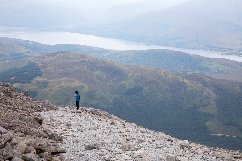
| 12.05 Checking the altitude. We are just under 700m. |
 |
||
|---|---|---|
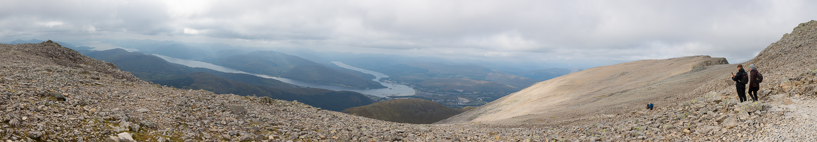
| 12.06 Panorama 604 From near the waterfall the path and loch are clear. |
 |
||
|---|---|---|
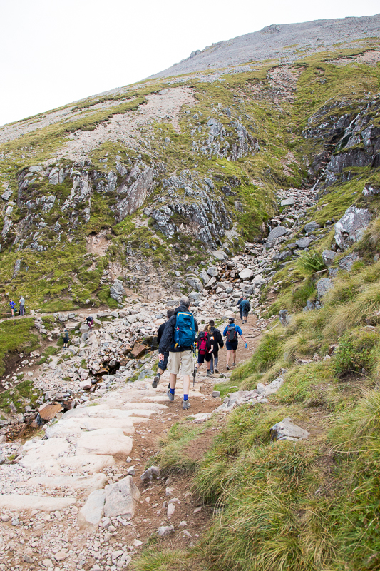
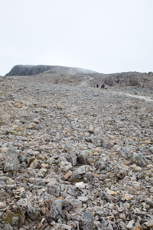
| 12.28 At the beginning of the zig-zag section of the walk. |
 |
||
|---|---|---|
| 12.49 |
 |
||
|---|---|---|
| 12.51 Panorama 605 On the third corner of the zig-zags at about 940m. |
 |
||
|---|---|---|
| 12.55 |
 |
||
|---|---|---|
| 13.16 |
 |
||
|---|---|---|
| 13.26 |
 |
||
|---|---|---|
| 13.27 |
 |
||
|---|---|---|
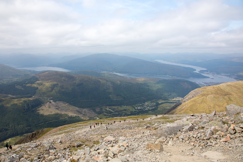
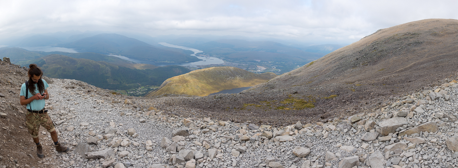
| 13.34 Panorama 606 Checking the altitude again. We are near the end of the zig-zag section at about 1200m. |
 |
||
|---|---|---|
| 13.41 The loch disappears again. |
 |
||
|---|---|---|
| 13.45 We are level with the lowest cloud now . |
 |
||
|---|---|---|
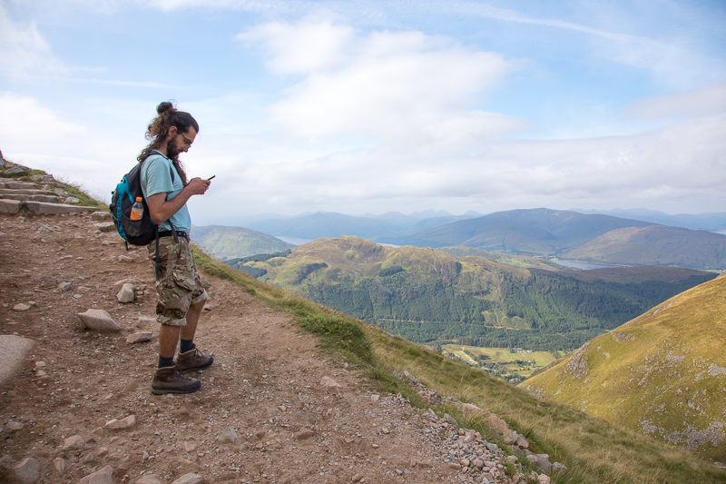
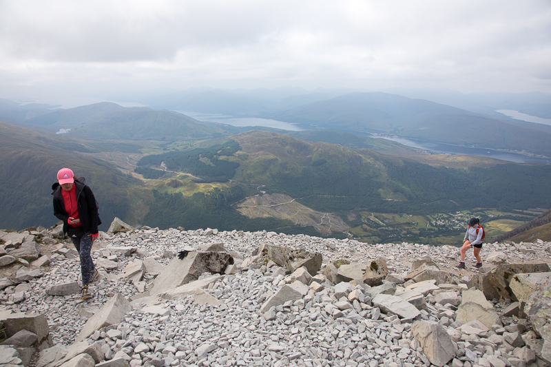
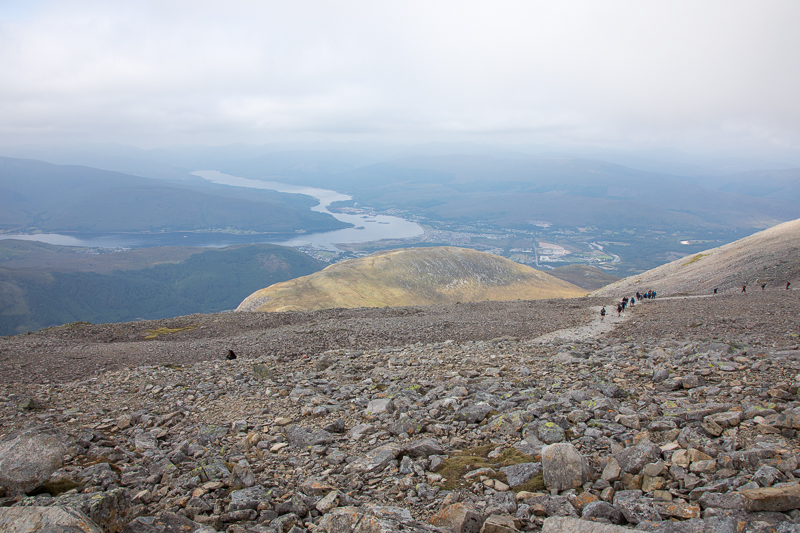
| 13.55 On the final stretch up the the summit. Its starting to get noticeably colder so we stop to put our fleeces on. We are at about 1250m. |
 |
||
|---|---|---|
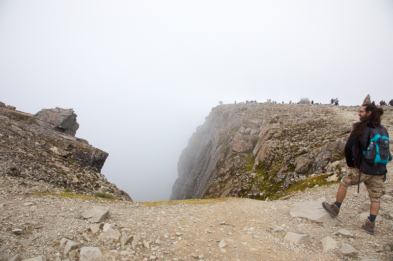
| 14.19 Looking down number 2 gully. We are at 1300m with the summit in the background. |
 |
||
|---|---|---|
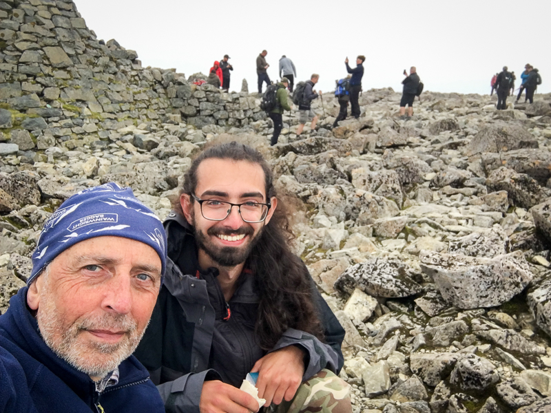
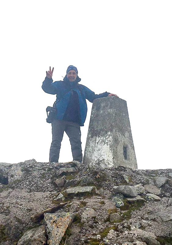
| 14.35 Summit selfie |
 |
||
|---|---|---|
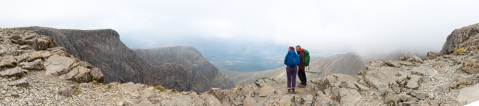
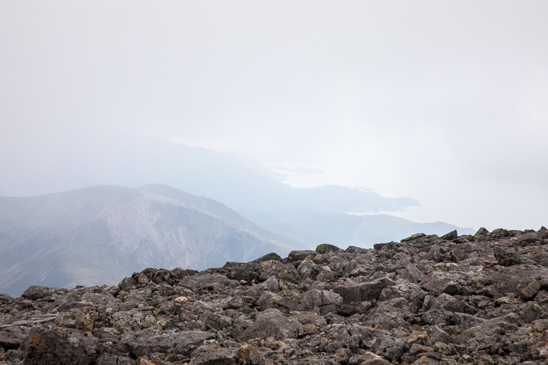
| 15.07 Panorama 607 When we first arrived on the summit visibility was poor in all directions. So we added more layers, had lunch and managed to make a phone call to Anna as it was her birthday. After a few minutes the mist cleared briefly and I managed to get this panorama facing north from the summit. |
 |
||
|---|---|---|
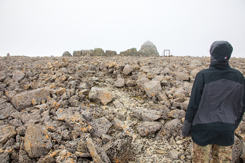
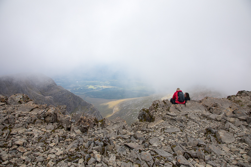
| 15.12 We wandered south on the summit hoping for a view down in that direction but visibility was poor. This was once a building on the summit. In the middle of this picture is what pretends to be a path across the rocks. |
 |
||
|---|---|---|
| 15.15 This was as good as it got looking south. |
 |
||
|---|---|---|
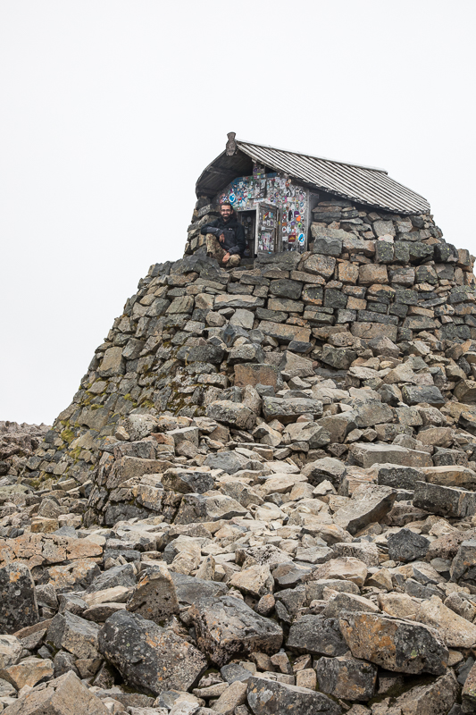
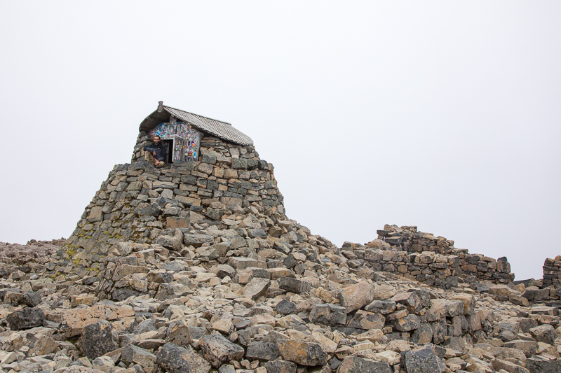
| 15.22 The summit hut |
 |
||
|---|---|---|
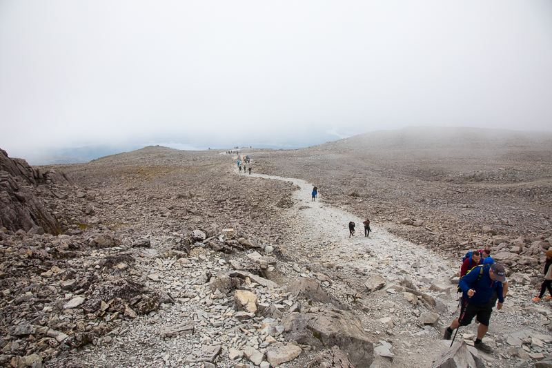
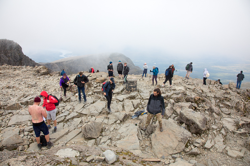
| 15.22 The summit area is getting less busy now. When we arrived an hour ago there was a queue to get up there. |
 |
||
|---|---|---|
| 15.23 The cloud has come down a bit since the panorama 16 minutes ago. |
 |
||
|---|---|---|
| 15.28 Highest person in the UK ! |
 |
||
|---|---|---|
| 15.29 Taking my turn standing on the summit. Only 3 people waiting in the queue now. The guy with no shirt is just getting dressed after posing on the top wearing his boots, bobble hat and a strategically taped face mask which was in his football team colours. |
 |
||
|---|---|---|
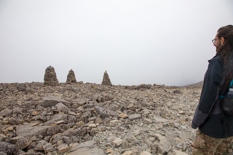
| 15.34 Starting back down, these three cairns mark a slight right turn in the path. |
 |
||
|---|---|---|
| 15.38 |
 |
||
|---|---|---|
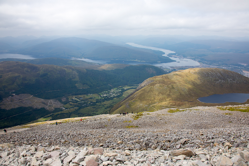
| 15.41 Back at about 1250m. |
 |
||
|---|---|---|
| 15.48 |
 |
||
|---|---|---|
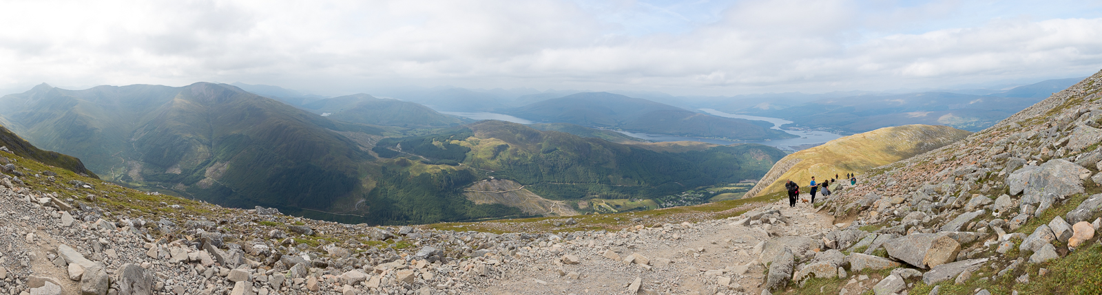
| 15.56 Panorama 608 From the large cairn viewpoint at the top of the zig-zags. 1220m. |
 |
||
|---|---|---|
| 15.59 Looking back at the summit. |
 |
||
|---|---|---|
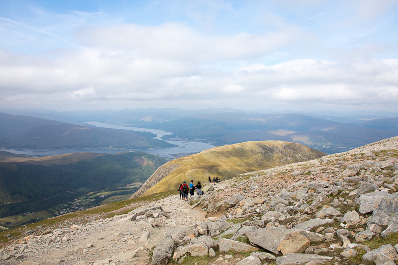
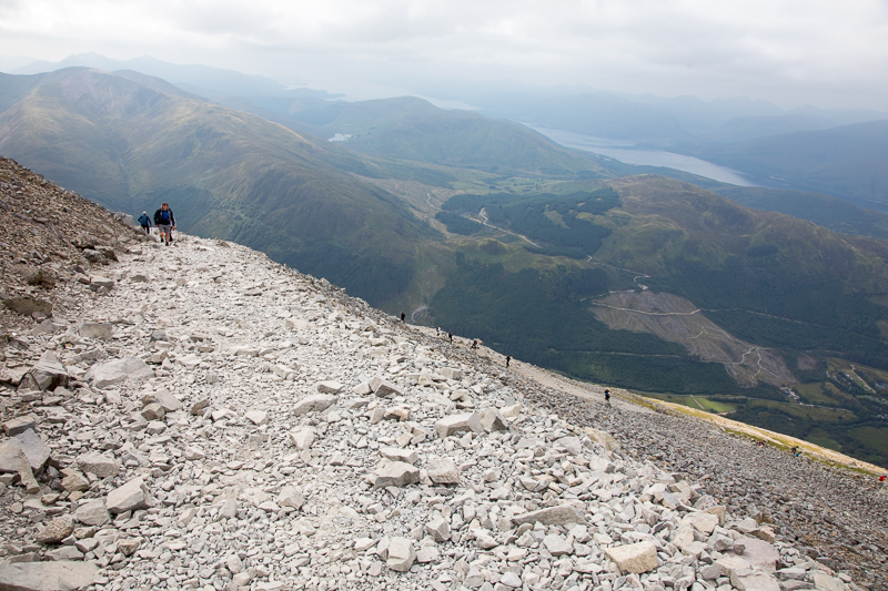
| 16.07 Back on the zig-zags. |
 |
||
|---|---|---|
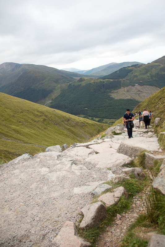
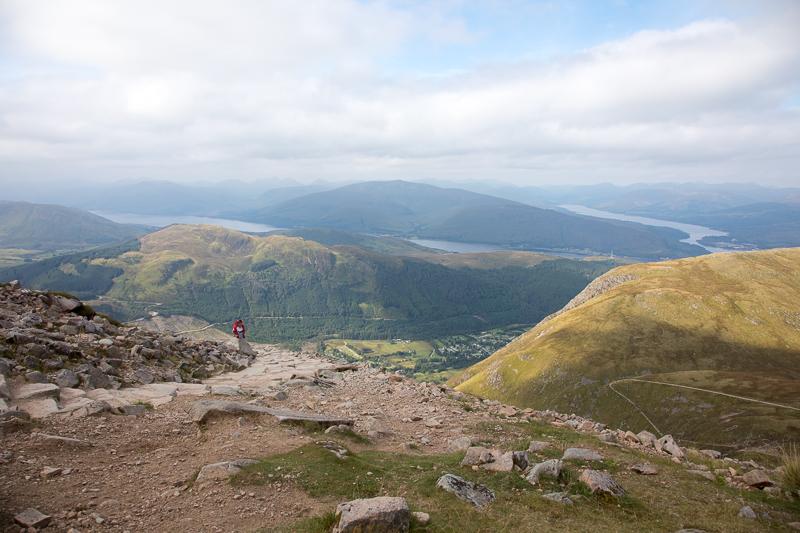
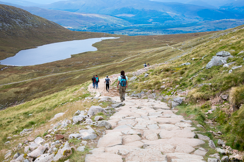
| 17.03 Just past the waterfall. A much more solid path lower down. |
 |
||
|---|---|---|
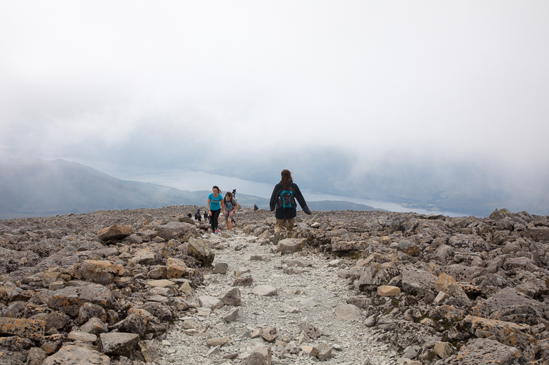
| 17.25 On the gravel path near the lake. |
 |
||
|---|---|---|
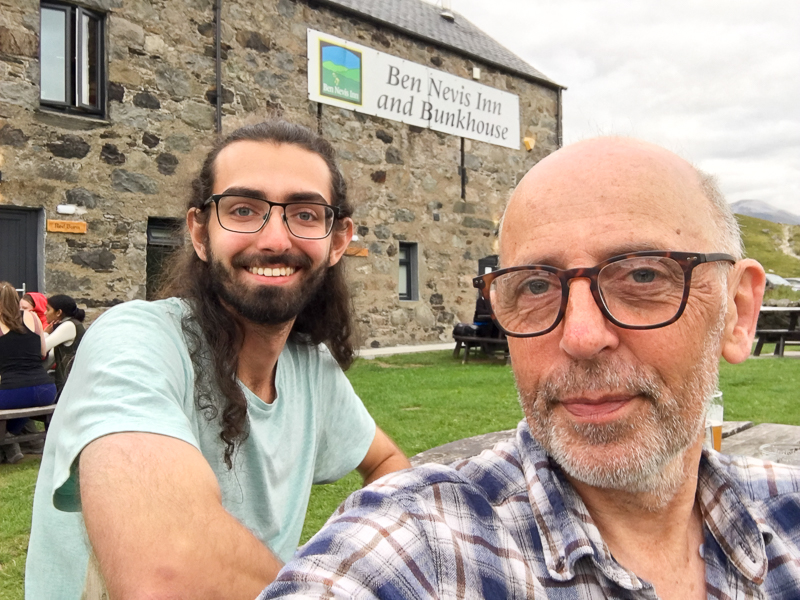
| 18.34 Back for a pint at the Ben Nevis Inn. 81/2 hrs all in including an hour on the top. |
 |
||
|---|---|---|
| 18.47 Not fast enough to get the drinks in the picture ! |
 |
||
|---|---|---|
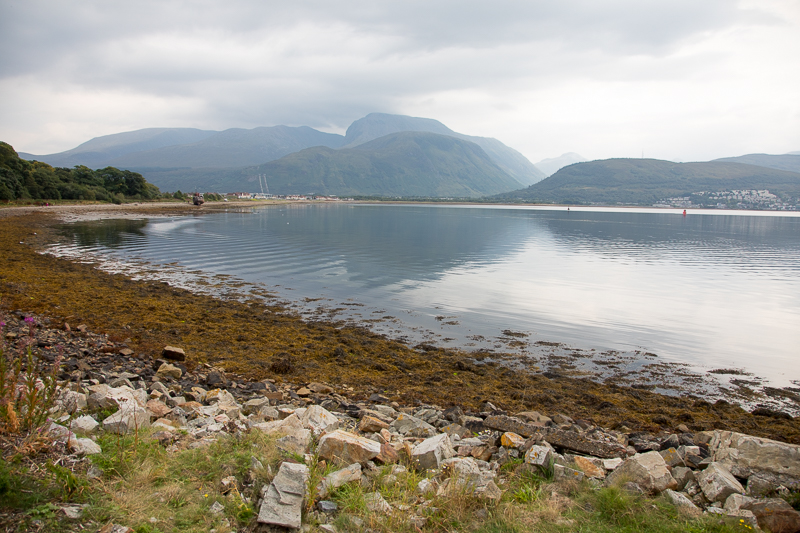
| 13.31 The following day we drove over to Corpach for a view of Ben Nevis across the bay. We enjoyed a much needed rest day. Chilled out here, then a bit of shopping in Fort William and a trip to the independent cinema that also serves pizza. Then back to our hotel in Spean Bridge and packing up ready for a 500 mile drive home. |
 |
||
|---|---|---|
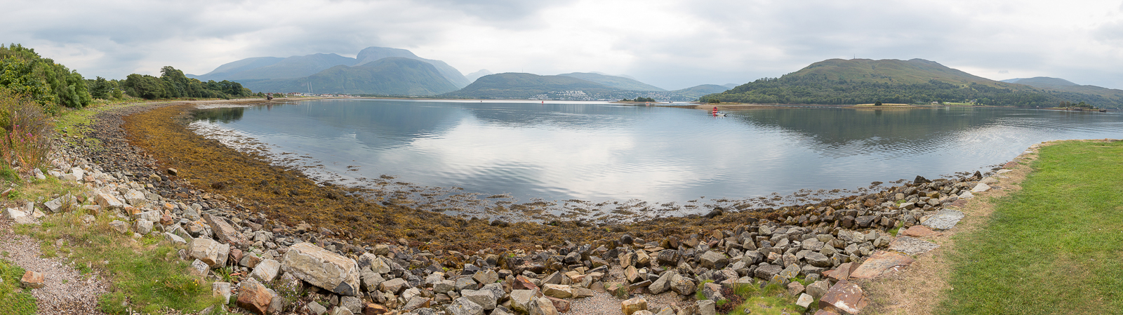
| 13.33 Panorama 609 This water is either the top of Loch Linhe or the bottom of Loch Eil |
 |
||
|---|---|---|
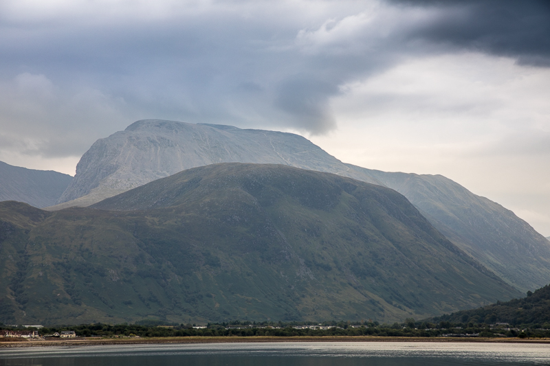
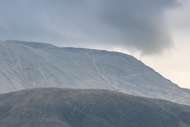
13.38 Close up of Ben Nevis. Its just possible to make out part of the zig-zag section of the path. |
 |
||
|---|---|---|
13.38 A heavily zoomed crop shows the lower part of the path.Top left is the summit. Bottom right with a curve is the section from the waterfall to the zig-zags. Then the first four sections of zig-zag are visible. An alternative much steeper path is visible from the 4th corner of the zig-zags. |
 |
||
|---|---|---|
| 14.02 |
 |
||
|---|---|---|
| 14.04 |
 |
||
|---|---|---|
| 14.18 Neptune's Staircase locks start here. |
|
|
 |
|---|