Walk 93 - Base Brown - 20th September 2024 |
||||
Wainwright's Walking Guide to the Lake District Fells - Book 7 The Western Fells |
||||
#208 Base Brown 2119 ft |
 |
Distance |
4 miles |
|
Time |
5 hrs |
|||
Lowest Point |
412 ft |
|||
Highest Point |
2119 ft |
|||
Total Ascent |
1776 ft |
|||
Walk Rating - moderate |
||||
 |
Mini Route Map Go to walk start
|
 |
|---|
 |
||
|---|---|---|
14.06 Leaving the farm at Seathwaite. |
 |
||
|---|---|---|
14.18 On the path up the side of Sourmilk Gill. |
 |
||
|---|---|---|
| 14.25 Seathwaite below |
 |
||
|---|---|---|
14.26 Waterfall viewpoint. |
 |
||
|---|---|---|
14.30 The beginning of the scramble over Seathwaite Slabs. |
Seathwaite Slabs - a training ground for novice rockclimbers . . . . . |
|||||
Alfred Wainwright - The Western Fells - Base Brown 6 |
|||||
 |
||
|---|---|---|
| 14.32 The slabs were a fairly easy scramble with good handholds but would be a bit tricky if they were wet. |
 |
||
|---|---|---|
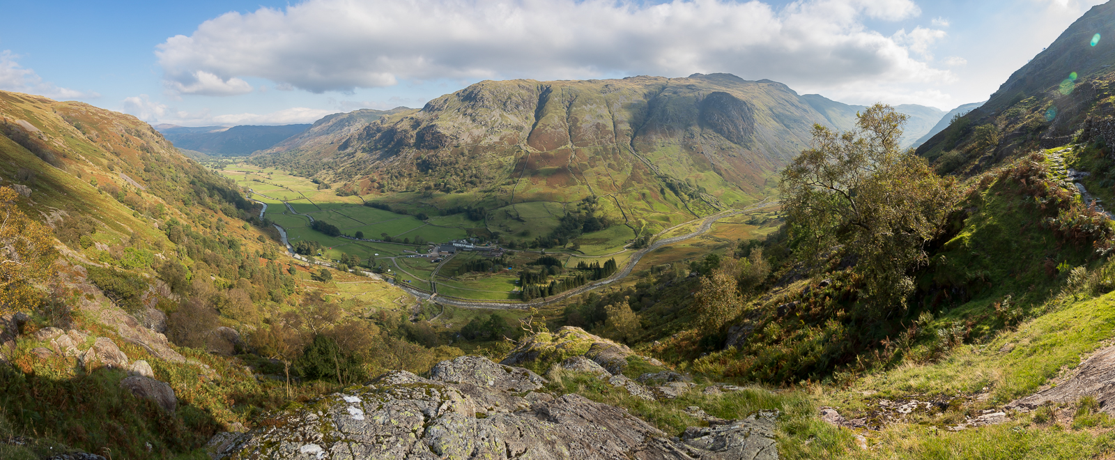
| 14.44 Panorama 1015 From a large rock viewpoint just below the wall. |
 |
||
|---|---|---|
| 14.48 Just above the gate with the viewpoint rock visible to its left. |
 |
||
|---|---|---|
| 14.53 Sourmilk Gill |
 |
||
|---|---|---|
| 14.53 Waterfall viewpoint |
 |
||
|---|---|---|
| 14.53 The gill plunging down to Seathwaite. |
 |
||
|---|---|---|
| 15.02 Leaving the gill head. |
 |
||
|---|---|---|
| 15.21 A few minutes along the path from the gill head. |
 |
||
|---|---|---|
| 15.23 Looking back |
 |
||
|---|---|---|
| 15.41 Looking back |
 |
||
|---|---|---|
| 15.50 We passed 3 girls from the north-east and a group of Duke of Edinburgh hikers. |
 |
||
|---|---|---|
| 15.54 High Spy in the distance |
 |
||
|---|---|---|
| 15.57 At the top of the path and joining the ridge which leads up to Green Gable to the south. |
 |
||
|---|---|---|
| 15.57 and in the same place looking back. |
 |
||
|---|---|---|
| 16.07 Great Gable in the distance. |

|
||
|---|---|---|
| 16.12 Panorama 1016 Base Brown summit, Wainwright #208 2119 ft. |

|
||
|---|---|---|
| 16.13 Panorama 1017 Base Brown summit, looking north. |
 |
||
|---|---|---|
| 16.45 Styhead from the side of Base Brown. |

|
||
|---|---|---|
| 16.47 Panorama 1018 Base Brown descent. I walked a hundred yards off the path to get a view to include Styhead. |
In good lighting conditions this view south to the Scafells calls for a photograph, but before releasing the shutter walk towards the scene until |
|||||
Alfred Wainwright - The Western Fells - Base Brown 8 |
|||||
 |
||
|---|---|---|
| 17.33 Returning to the top of the gill. |
 |
||
|---|---|---|
| 17.44 We spent some time looking for the hanging rock - the two in this picture were contenders and I think are the two mentioned by AW. |
The Hanging Stone is repeatedly featured conspicuously in successive editions of the Ordnance Survey maps, where its name is given as much prominence as that of the fell itself, People with bad coughs should keep out of the line of fall. The stone occupies a startling position balanced on the rim of a crag, apparently half of its bulk being unsupported and overhanging a void, Sixty yards further up the ridge a large boulder has come to rest on a number of smaller ones.
|
|||||
Alfred Wainwright - The Western Fells - Base Brown 4 |
|||||
 |
||
|---|---|---|
| 17.55 Time to refresh the feet at the top of Sourmilk Gill. |
 |
||
|---|---|---|
| 17.55 |
 |
||
|---|---|---|
| 17.57 The green grey rocks under the water were extremely slippery. |
 |
||
|---|---|---|
| 17.58 Top of the gill. |
 |
||
|---|---|---|
| 18.05 The road in Seathwaite below us. |
 |
||
|---|---|---|
| 18.24 The upper part of the slabs on the way down. |
 |
|---|