|
|
Walk 61 - Kayaking and Kirk Fell - 30th August 2021 |
||||
Wainwright's Walking Guide to the Lake District Fells - Book 7 The Western Fells |
||||
#145 Kirk Fell 2631 ft
|
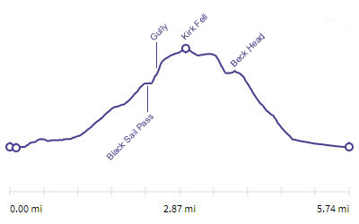 |
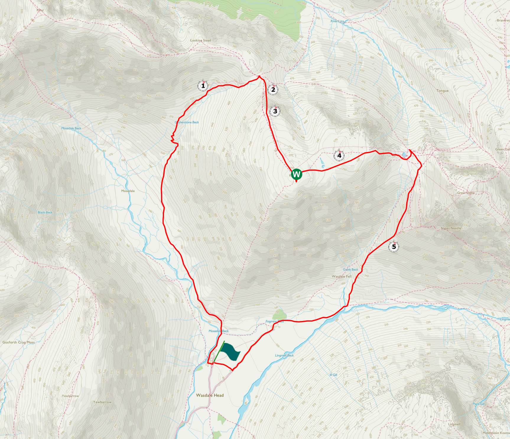
Distance |
5.7 miles |
|
Time |
5.5 hrs |
|||
Lowest Point |
261 ft |
|||
Highest Point |
2631 ft |
|||
Total Ascent |
2619 ft |
|||
Walk Rating - very tough due to the climb up the gully |
||||
 |
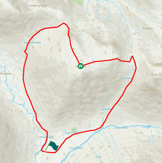
Mini Route Map Go to walk start
|
 |
|---|
 |
||
|---|---|---|
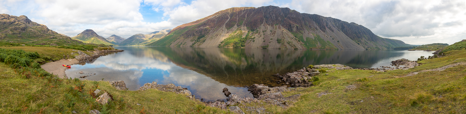
| 16.14 Panorama 566 The day before the Kirk Fell walk we spent the afternoon kayaking on Wastwater. With 3 kayaks between the 4 of us I paddled across to the scree side and then the kids took the kayak away. Various jokes were made about foxes, chickens and bags of grain. I got this view of Wastwater that most people don't see. After an hour I was rescued after a bit of shouting. |
 |
||
|---|---|---|
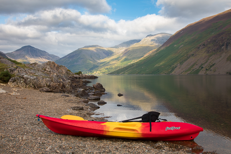
| 17.20 Panorama 567 Fortunately I had the red kayak for this shot back on the west side. Although Wastwater had been busy all week it was still really quiet and as I drifted gently along the edge of the lake I could speak to people on the bank in hushed tones. |
 |
||
|---|---|---|
| 17.23 Feelfree publicity shot? |
 |
||
|---|---|---|
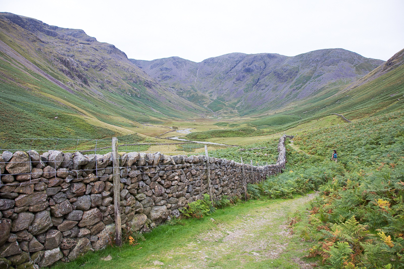
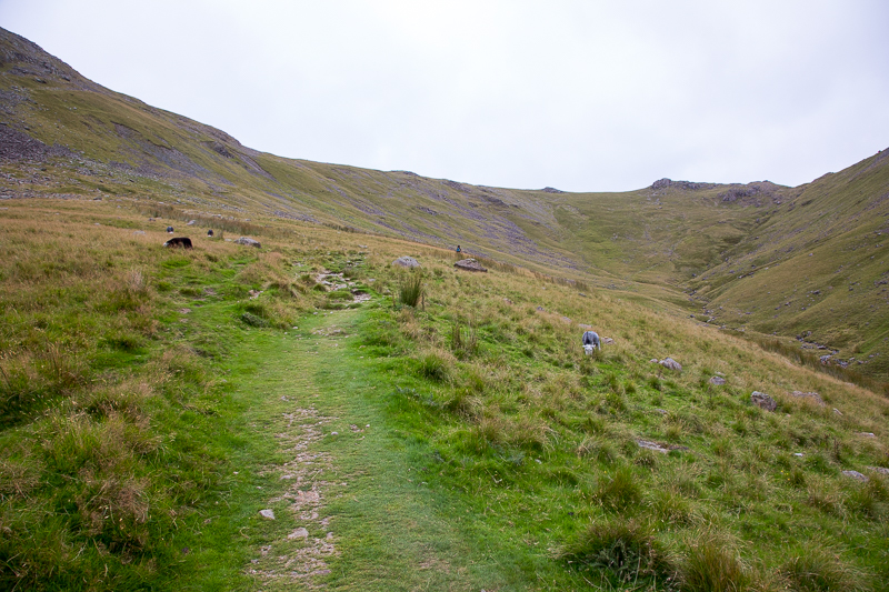
14.00 We set off from the cottage and up Mosedale. |
 |
||
|---|---|---|
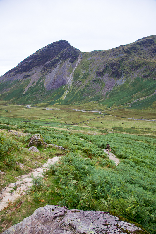
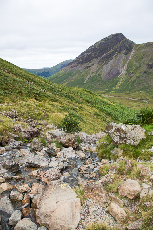
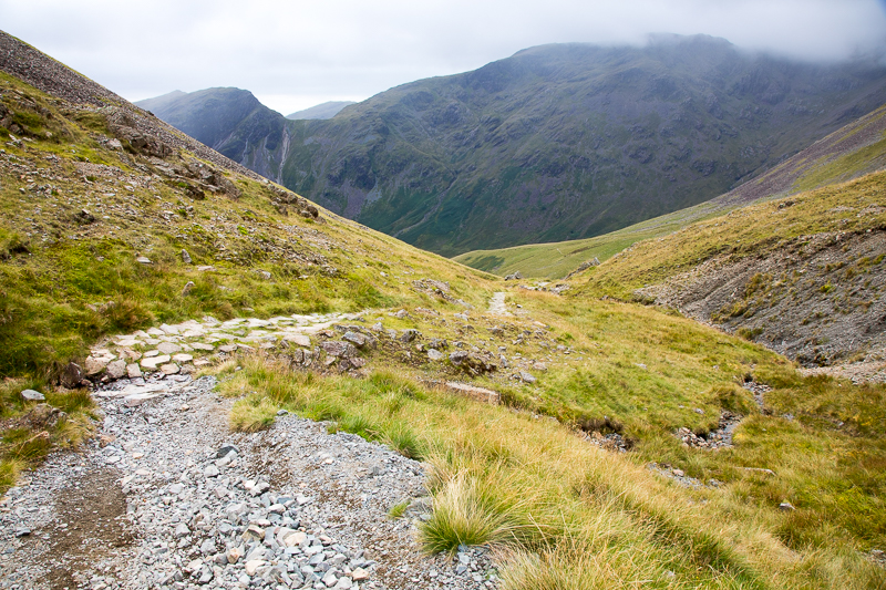
| 14.31 The path starts to rise after half an hour or so. |
 |
||
|---|---|---|
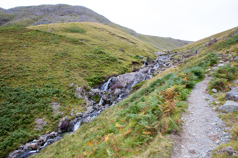
| 14.37 Gatherstone Beck |
 |
||
|---|---|---|
| 14.43 There is a large and very obvious crossing point which Nick missed and walked straight past, causing his role as lead navigator to be called into question. |
 |
||
|---|---|---|
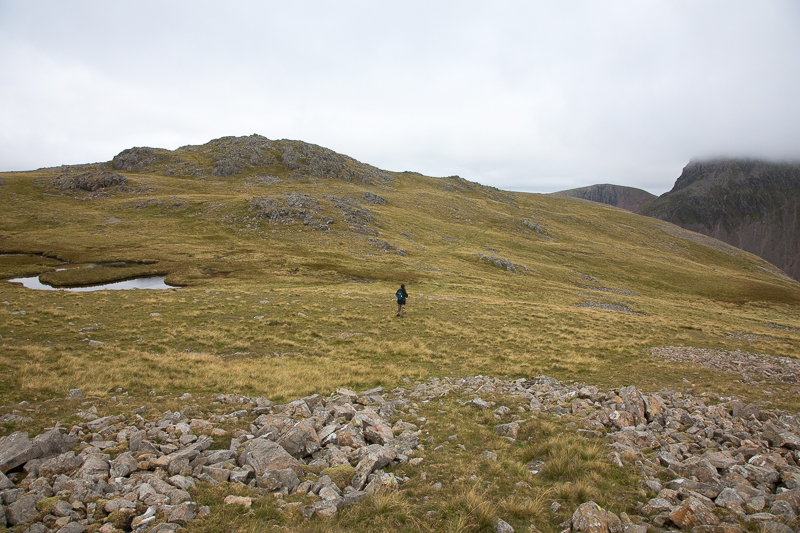
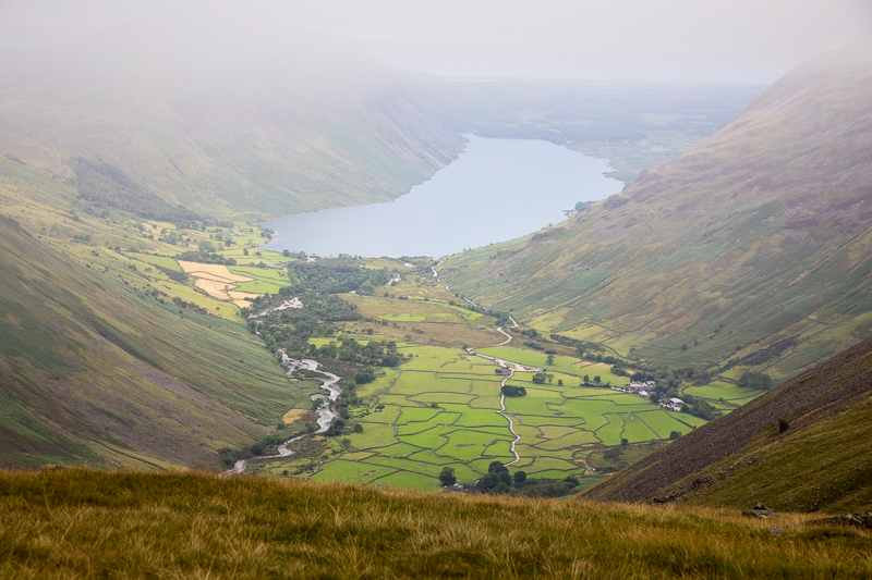
| 14.52 The top of the pass in sight and we are starting to feel a chill breeze coming over from the north. We met two people who had just come down the gully from Kirk Fell. When we asked how it was the lady said "Well I suppose you could climb up it......" |
 |
||
|---|---|---|
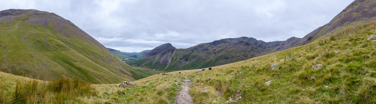
| 14.54 Panorama 568 Looking back down into Mosedale from 2/3 of the way up Black Sail Pass |
 |
||
|---|---|---|
| 15.23 A little higher up Middle Fell comes into view over Dore Head. |
 |
||
|---|---|---|
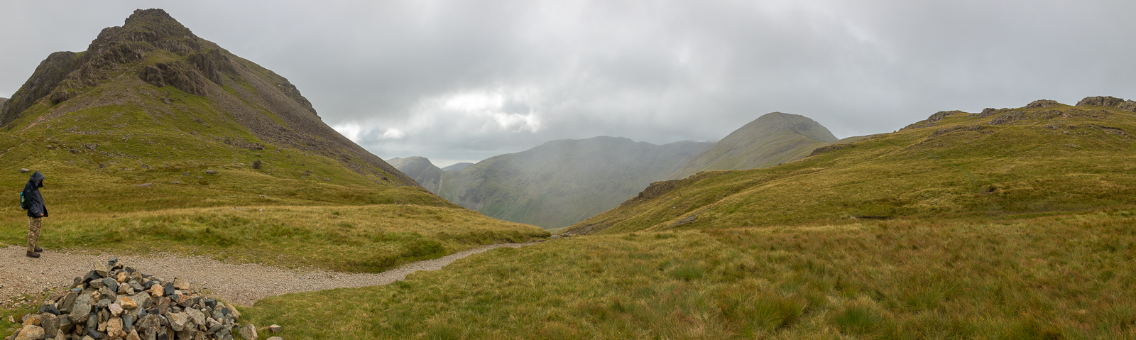
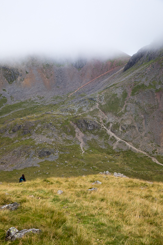
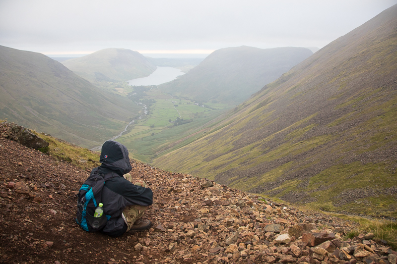
| 15.27 Panorama 569 At the top of Black Sail Pass and the weather has suddenly turned. We spent a while looking at the route options from here - scramble up the front, scramble up the gully or walk all the way down and around to the left. In the end we opted for the gully. (Never again!) |
 |
||
|---|---|---|
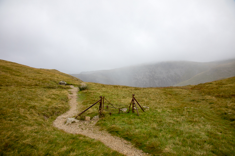
| 15.28 The famous broken down gate at the top of Black Sail Pass. |
 |
||
|---|---|---|
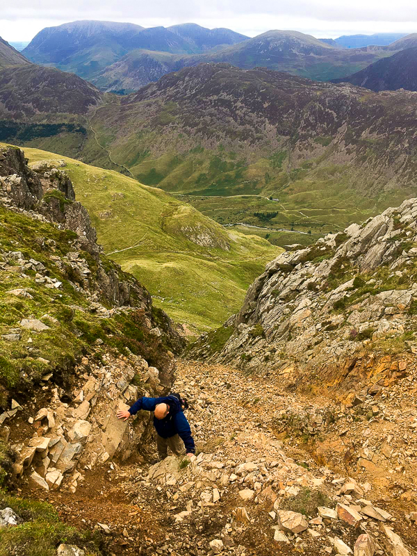
| 17.00 Emerging at the top of the gully after a strenuous 90 minutes getting up it. Very nerve wracking at times especially when we had to scramble up the side of the gully to pass a large chock stone and then later a double step which was too high to clamber over. Black Sail Youth Hostel in the background but we didnt spend much time enjoying the view on the way up. |
 |
||
|---|---|---|
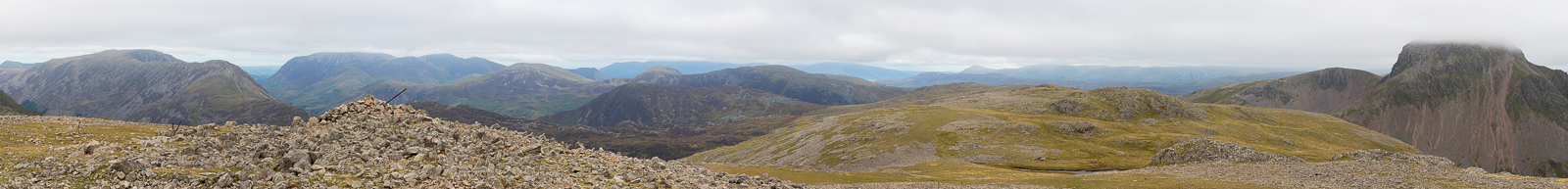
| 17.11 Panorama 570 On the summit of Kirk Fell looking north (Wainwright #145 2631ft). |
 |
||
|---|---|---|
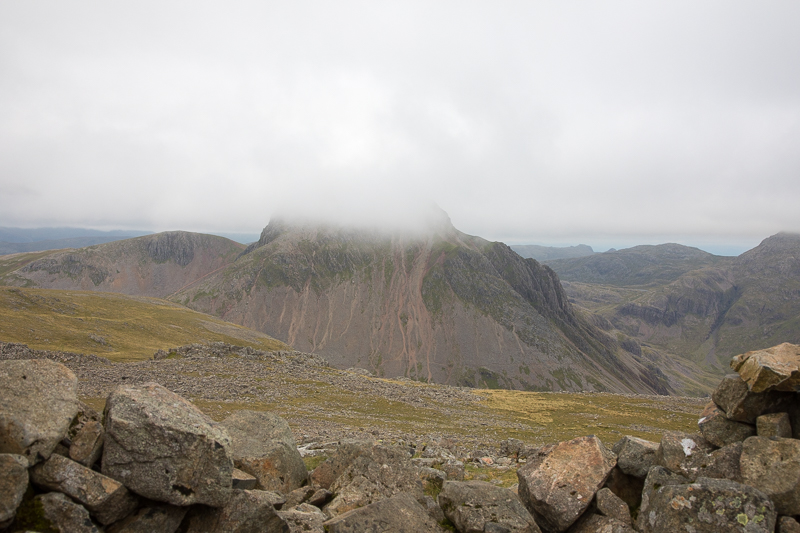
| 17.23 Great Gable shrouded in cloud. |
 |
||
|---|---|---|
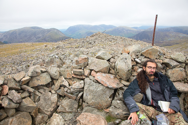
| 17.30 We both felt exhausted after the climb up that gully. |
 |
||
|---|---|---|
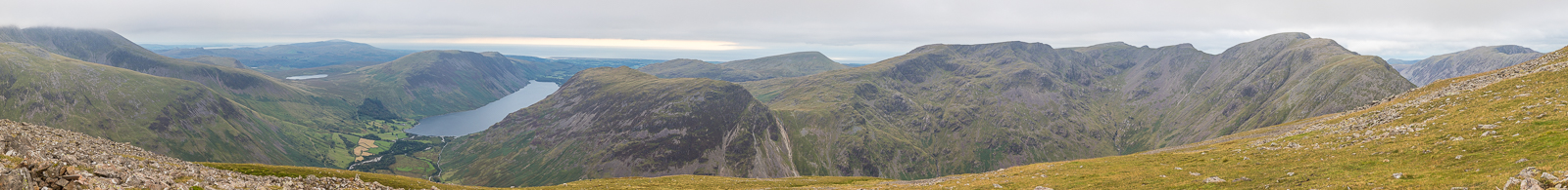
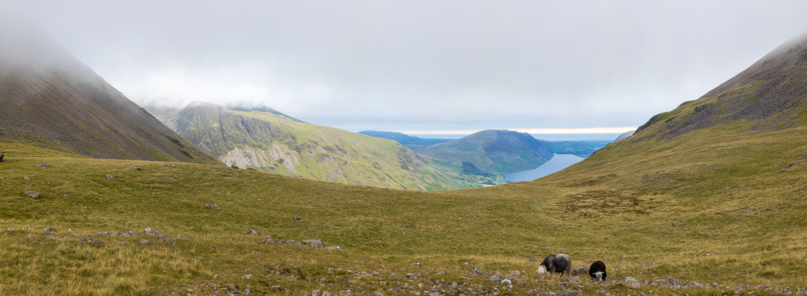
| 17.45 Panorama 571 On the summit of Kirk Fell looking south. |
 |
||
|---|---|---|
| 17.52 . Crossing the top of Kirk Fell. |
 |
||
|---|---|---|
| 18.17 Dropping down Rib End, on the east side of Kirk Fell, onto Beck Head. The path up Great Gable is visible on the right and in the background the red path that runs up the side of Green Gable to Windy Gap. We would come down that path in a few days time. |
 |
||
|---|---|---|
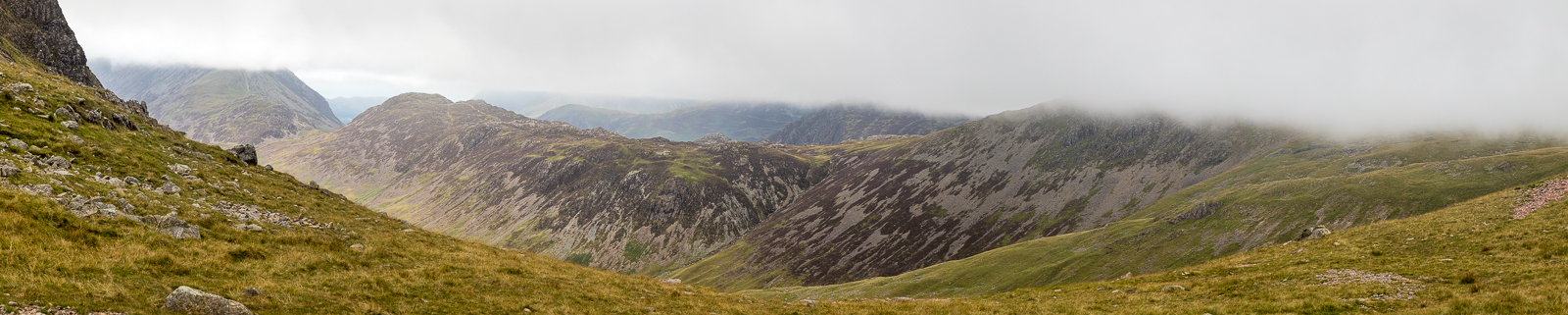
| 18.34 Panorama 572 Looking south from Beck Head. |
 |
||
|---|---|---|
| 18.36 Panorama 573 Looking north from Beck Head only Haystacks was managing to get under the cloud which had dropped since we were on Kirk Fell summit. It was now a steady layer at around 2000ft. |
 |
||
|---|---|---|
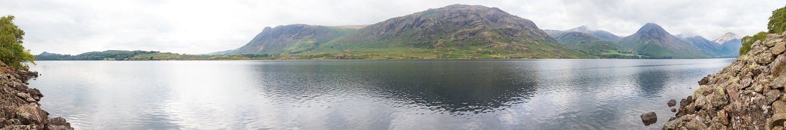
| 18.40 Wastwater and Wasdale Head from Beck Head. Our cottage is visible. |
 |
||
|---|---|---|
| 18.49 A stop on the path down the side of Great Gable. It was good to walk this path because it was very clearly visible from our cottage and we had often wondered what it would be like. Light rain patches drifted through but this was the only damp weather we had all week and even this was hardly really rain. |
|
|
 |
|---|