|
|
Walk 76 - Hartsop Dodd / Caudale Moor - 18th September 2022 |
||||
Wainwright's Walking Guide to the Lake District Fells - Book 2 The FarEastern Fells |
||||
#177 Hartsop Dodd 2028 ft |
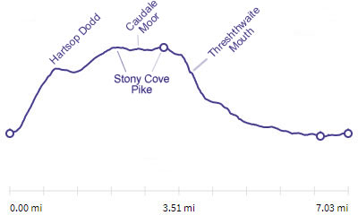 |
Distance |
7 miles |
|
Time |
6.5 hrs |
|||
Lowest Point |
514 ft |
|||
Highest Point |
2503 ft |
|||
Total Ascent |
2357 ft |
|||
Walk Rating - tough, steep gradients and a long return |
||||
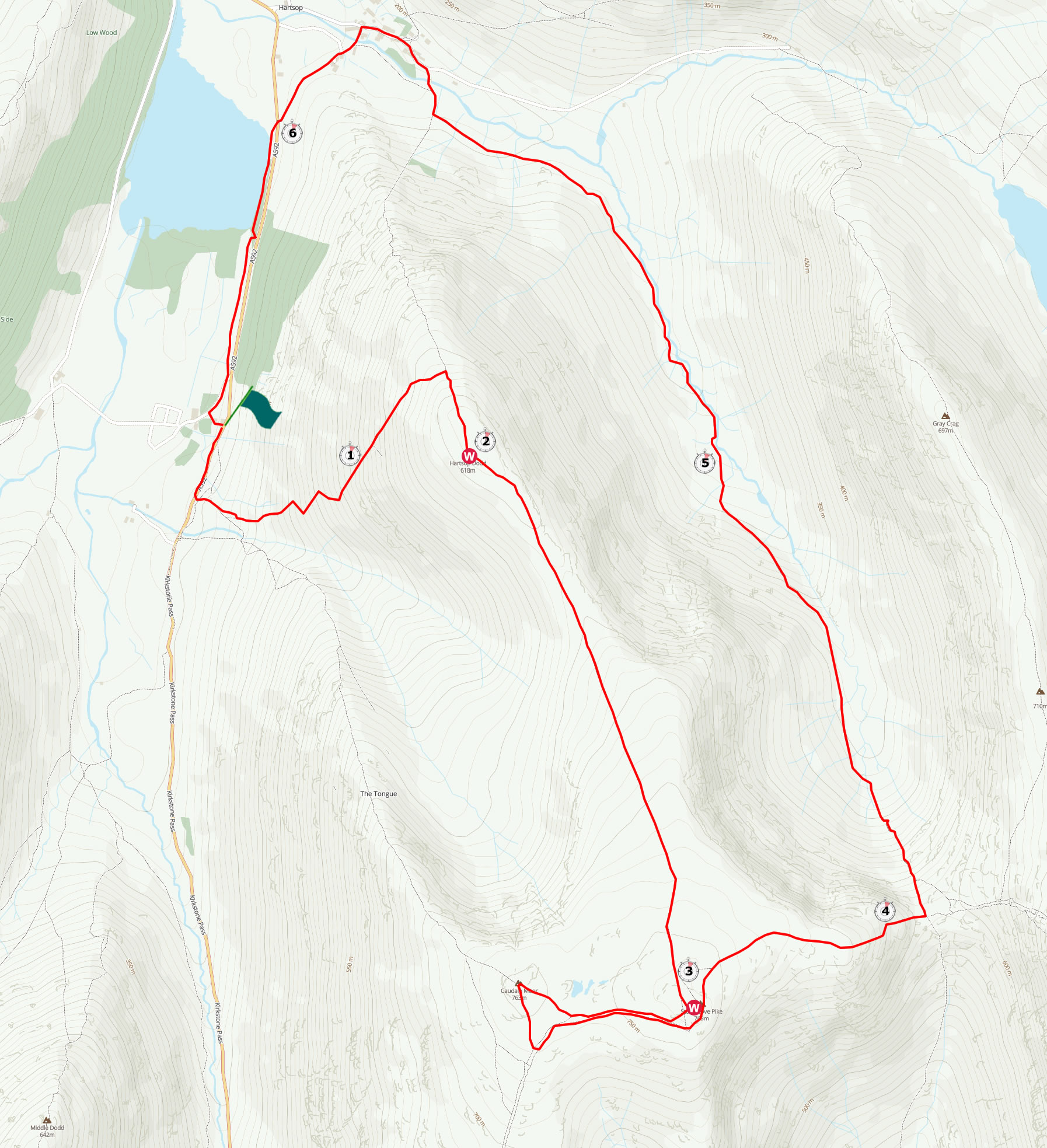
| We started at the Brotherswater Inn and walked up the road towards Kirkstone Pass before entering the fell through a gate on the left. We zig-zagged uphill before angling left up the side of the fell. This went on for some time and became very steep at one point. As the ground leveled out we turned right and ascended the last easier part to the summit of Hartsop Dodd. It was an easy walk up to Stoney Cove Pike and around the top of Caudale Moor. We took a steep descent into Threshthwaite Mouth before a long trek down the valley to Hartsop. We took a side path from Hartsop, crossing the road and walking along the Brotherswater shore path back to the pub. | ||||
 |
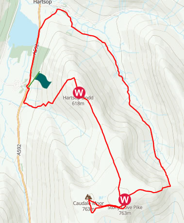
Mini Route Map Go to walk start
|
 |
|---|
 |
||
|---|---|---|
| 12.58 We parked at the Brotherswater Inn, walked up the road for 5 minutes and then turned up onto the fell. |
 |
||
|---|---|---|
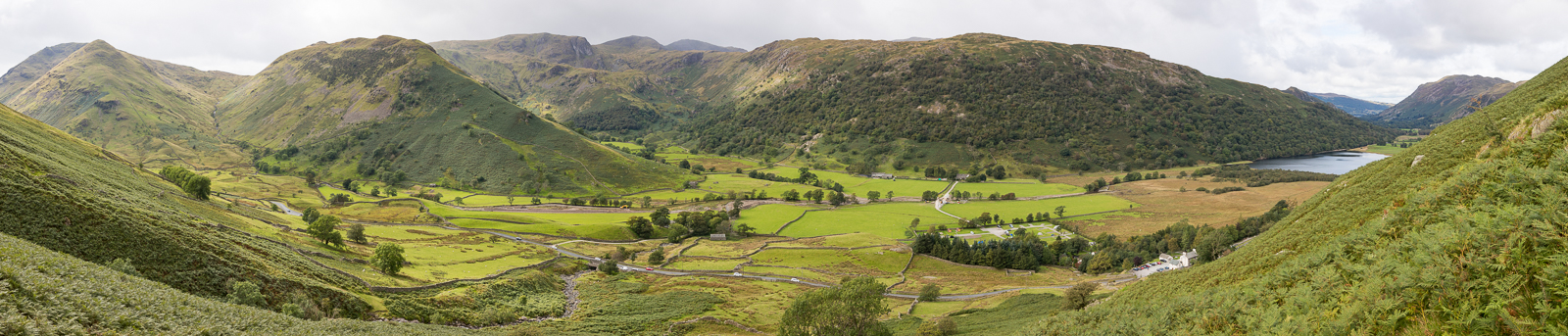
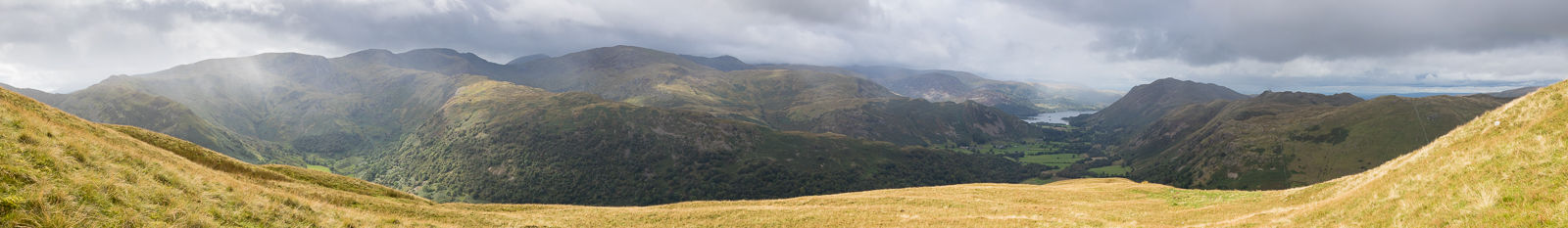
| 13.23 Panorama 749 On the lower part of the Shepherd's Path we got lost in the bracken and had to use the app slightly to get us back on the route. Initially the path was fine - this was taken at around 1050ft on the lower part of the zig zags. Later the path turned into one long diagonal line climbing up the side of the fell. |
 |
||
|---|---|---|
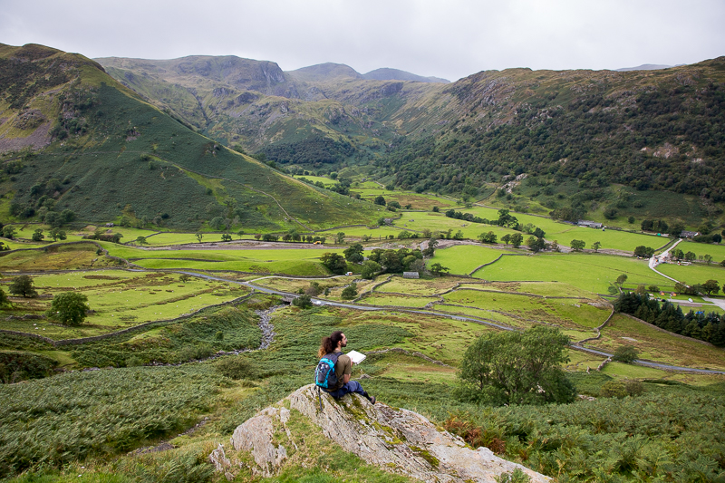
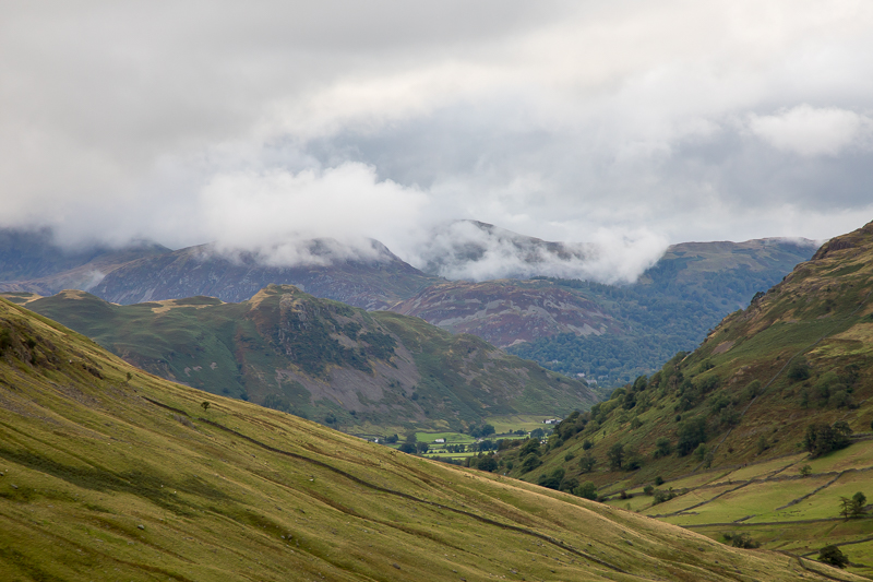
| 13.25 Identifying features in the valley. The ancient settlement is visible in the field at the bottom of Low Hartsop Dodd. We had walked through it on the day we climbed Red Screes. |
 |
||
|---|---|---|
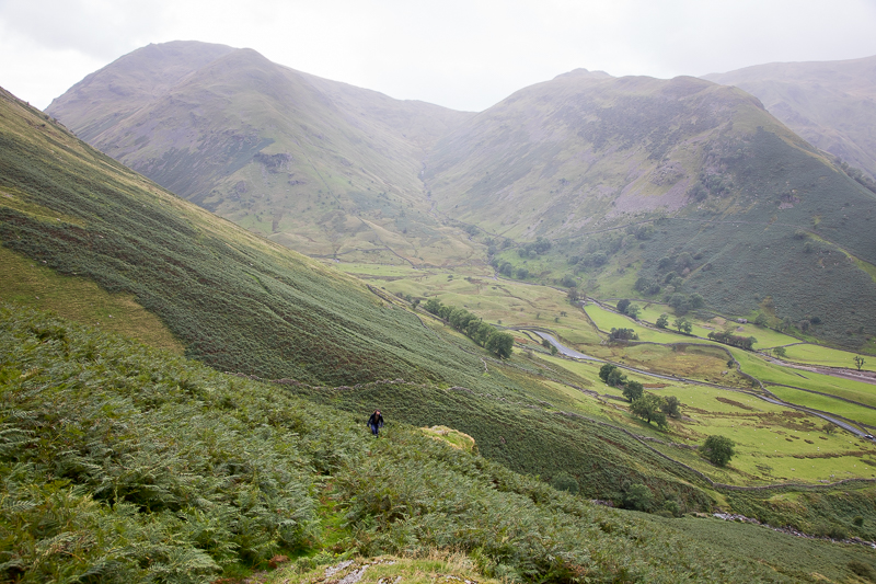
| 13.36 Red Screes and High Hartsop Dodd. The path we are on is visible from High Hartsop Dodd in this photo from 2019. |
 |
||
|---|---|---|
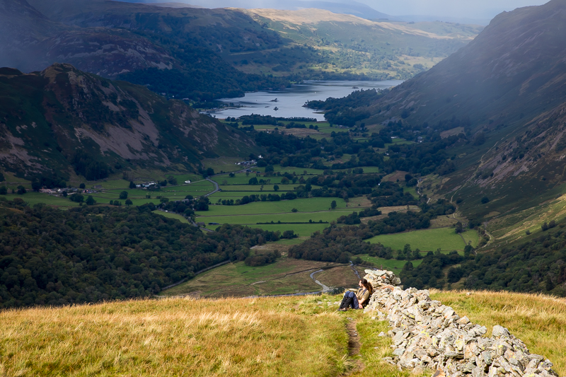
| 13.39 A ghostly rainbow over Brotherswater. We are nearly above the bracken now but some way to go on the longest final leg of the path. It was also very steep and I had to put my camera away so I could hold on properly. Around 1500 ft the level part of the track disappeared completely for 50m or so and I was "walking" using one foot, the other knee and two hands to haul my way up. |
 |
||
|---|---|---|
| 14.49 Panorama 750 After several stops and a few rain showers we reached the turn where the slope was much easier. |
 |
||
|---|---|---|
| 14.55 Taking a breather just below the final ascent. |
 |
||
|---|---|---|
| 14.57 Frequently changing light and drifting rain was a feature today. |
 |
||
|---|---|---|
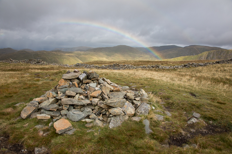
| 14.58 Then the magic moment of the trip. Literally as I reached the summit my first Wainwright rainbow appeared. |
 |
||
|---|---|---|
| 14.59 Panorama 751 Hartsop Dodd summit and I could not have timed it better. (Wainwright #177 2028 ft) |
 |
||
|---|---|---|
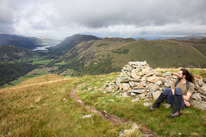
| 15.00 The cairn although the actual summit is given by Wainwright as a fence post about 50yds away. |
 |
||
|---|---|---|
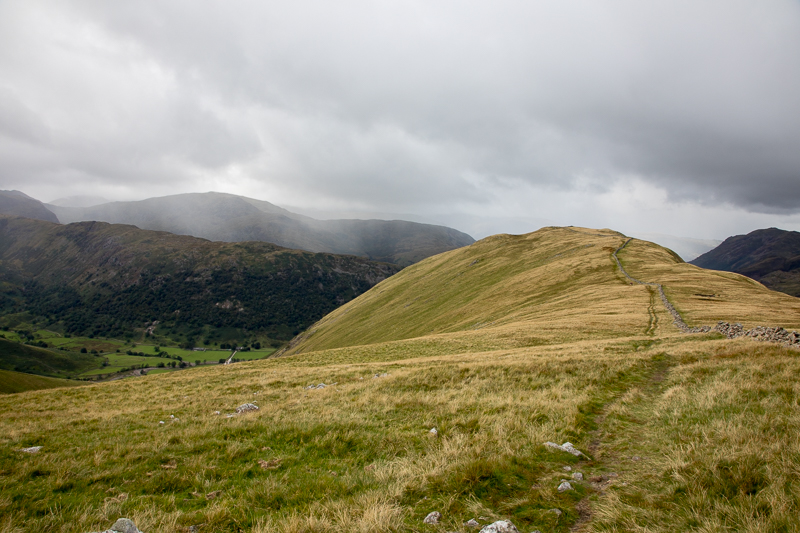
| 15.16 The start of a much easier walk up to Caudale Moor - looking back at Hartsop Dodd. |
 |
||
|---|---|---|
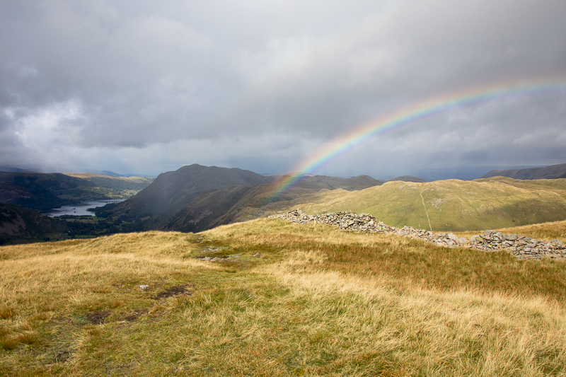
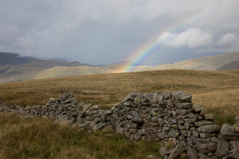
| 15.31 Another rainbow over yesterday's route. |
 |
||
|---|---|---|
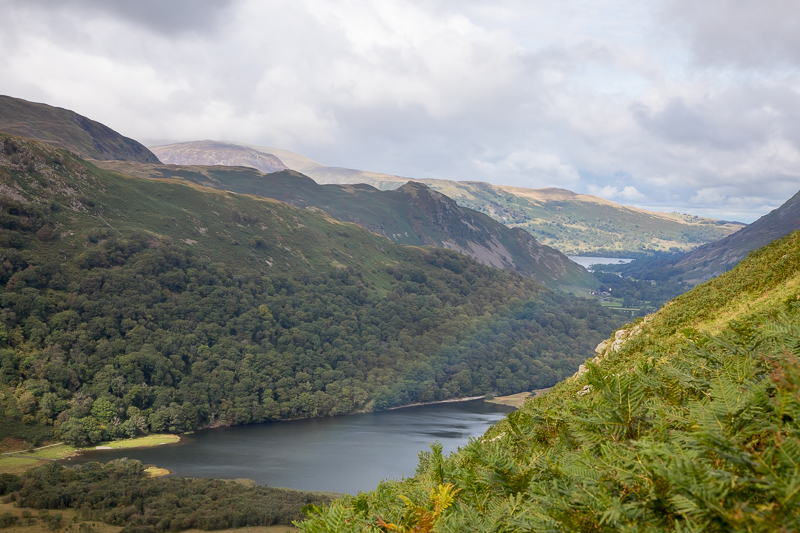
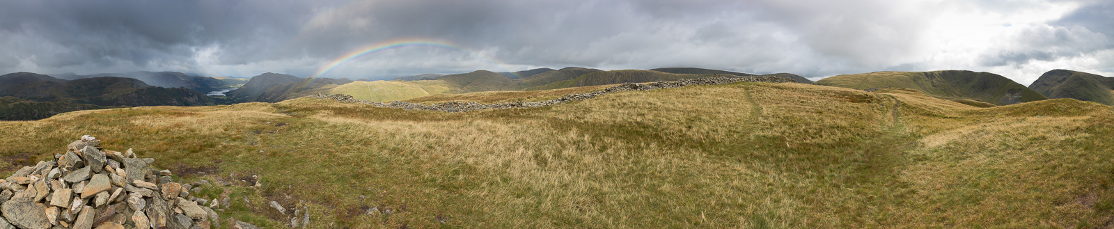
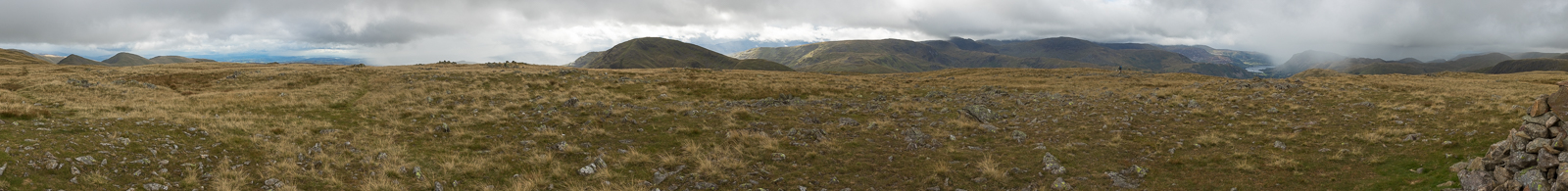
13.52 Panorama 752 Stony Cove Pike and a view of Wondermere suddenly appeared (Wainwright #178 2503 ft) |
 |
||
|---|---|---|
| 14.01 Panorama 753 This is from is another summit cairn to the west of Stony Cove Pike which is at the same height (labelled Caudale Moor on the OS app.) |
 |
||
|---|---|---|
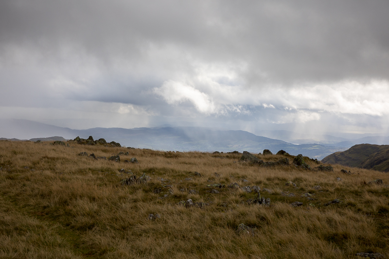
| 15.59 Drifiting rain to the south. |
 |
||
|---|---|---|
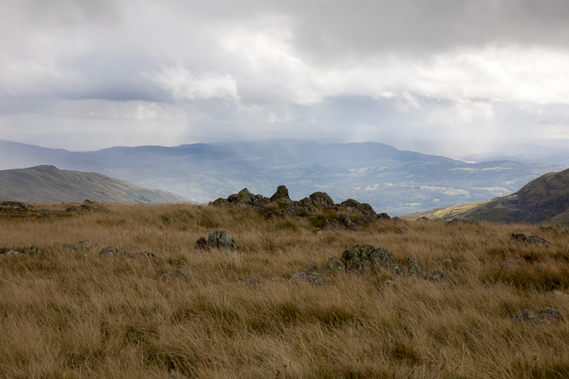
| 16.00 Looking south. |
 |
||
|---|---|---|
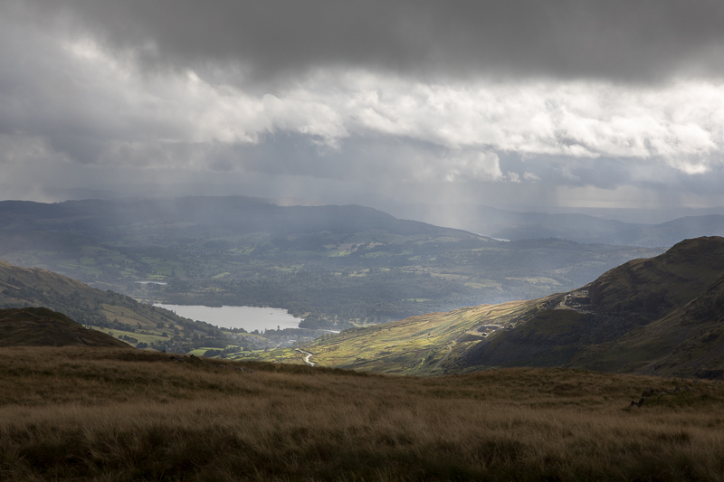
| 16.01 The top of Windermere and "The Struggle" coming up from Ambleside. |
 |
||
|---|---|---|
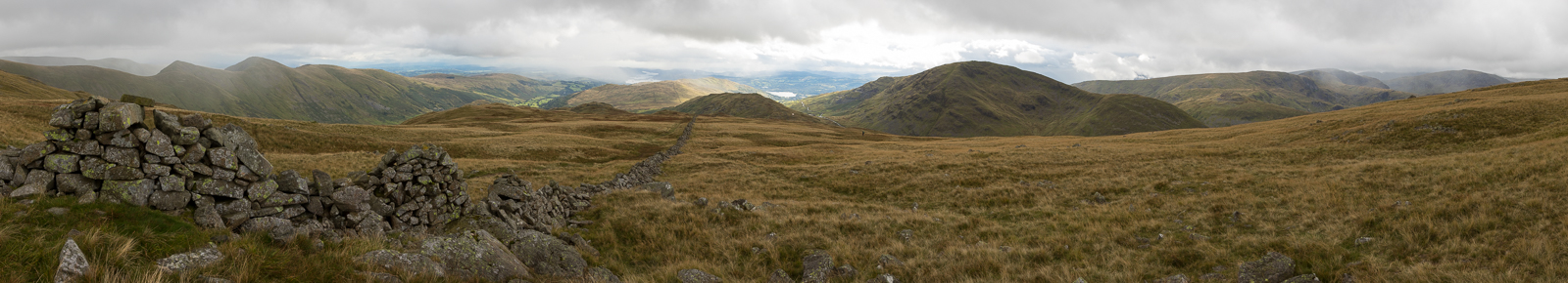
| 16.05 Panorama 754 We had a late lunch sheltering behind this wall before turning east, hoping to get to Gray Crag. |
 |
||
|---|---|---|
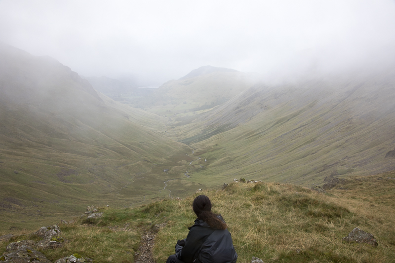
| 17.19 By about 5pm we had come down the east side of Stony Cove Pike into Threshthwaite Mouth. It had been getting gradually gloomier, raining on and off and no visibility over to Gray Crag and Thornthwaite Crag. At the bottom we chatted to another hiker who had come the other way and intended wild camping somewhere nearby so she could see an inversion in the morning. It was at this point that we decided to call it a day and began heading down the valley towards Hartsop. |
 |
||
|---|---|---|
| 18.03 Drifting clouds over Helvellyn to the north west. |
 |
||
|---|---|---|
| 18.03 It was proving to be quite a long walk down the valley. We stopped fo a quick snack break. |
 |
||
|---|---|---|
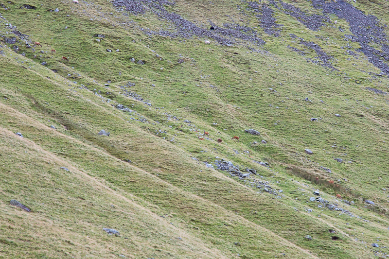
| 18.08 It was then that we noticed about 20 red deer on the far side of the valley, much closer than yesterday's. |
 |
||
|---|---|---|
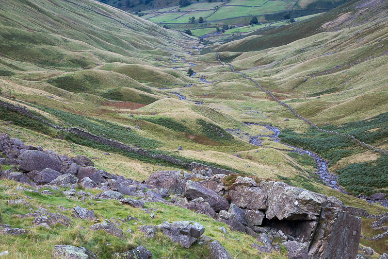
| 18.16 Drumlins in the lower part of the valley. |
 |
||
|---|---|---|
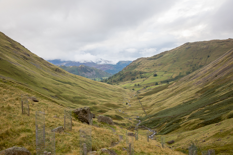
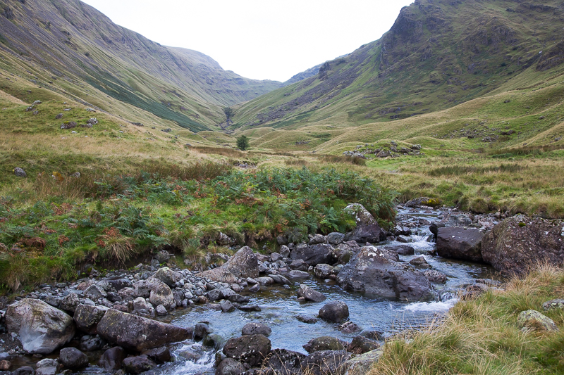
| 18.37 Looking back up the valley to Threshthwaite Mouth. It has taken us about an hour and a half to walk down from the top. |
 |
||
|---|---|---|
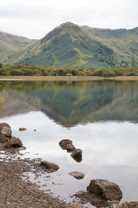
| 19.09 We took the path along the side of Brotherswater to get back to the inn. High Hartsop Dodd over the water. |
|
|
 |
|---|