|
|
I also have a page outlining most of the routes up Scafell Pike |
|
|
|---|
Walk 50 - Scafells - 24th August 2020 |
||||
Wainwright's Walking Guide to the Lake District Fells - Book 4 The Southern Fells |
||||
#119 Lingmell 2625 ft |
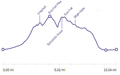 |
Distance |
9.7 miles |
|
Time |
13 hrs |
|||
Lowest Point |
216 ft |
|||
Highest Point |
3209 ft |
|||
Total Ascent |
4675 ft |
|||
Walk Rating - very tough |
||||
 |
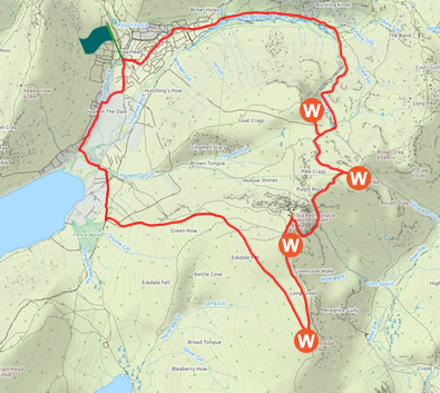
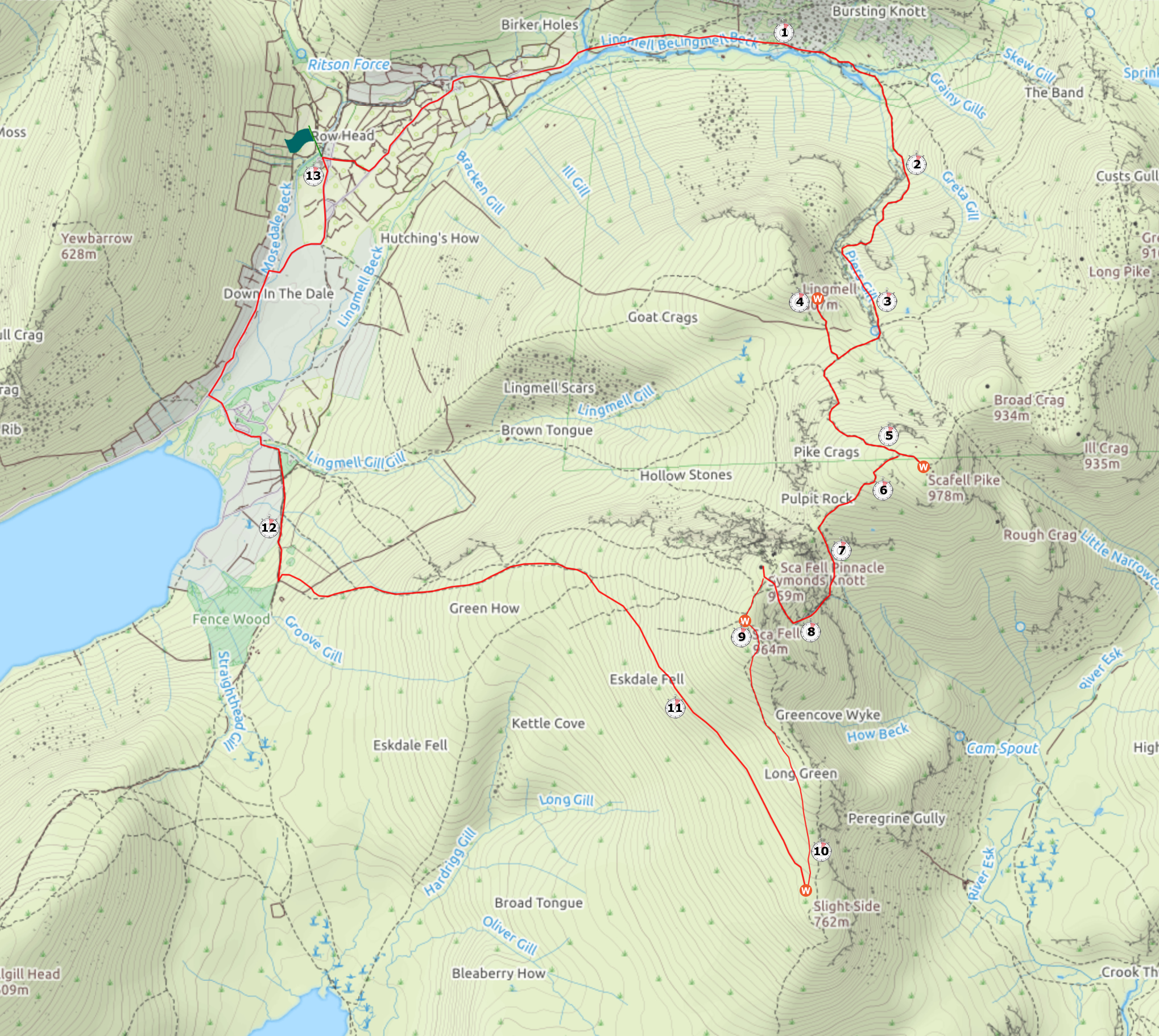
Mini Route Map Go to walk start
|
 |
|---|
 |
||
|---|---|---|
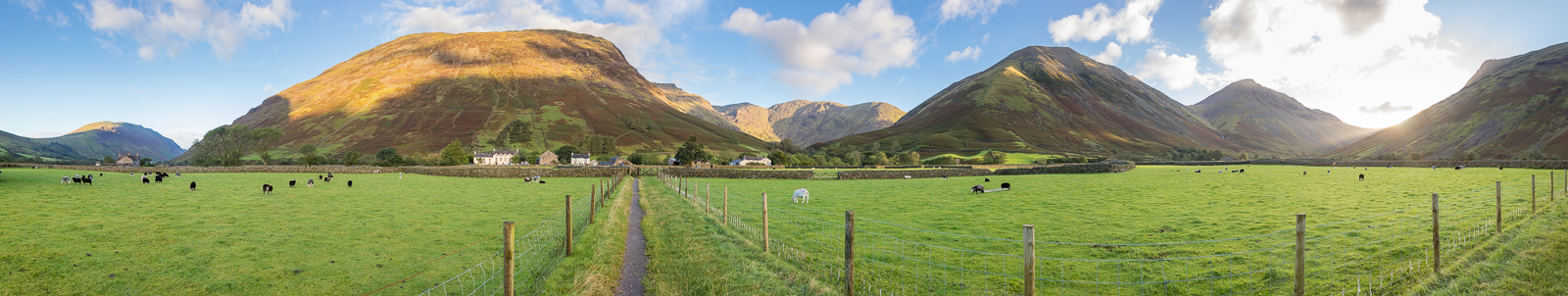
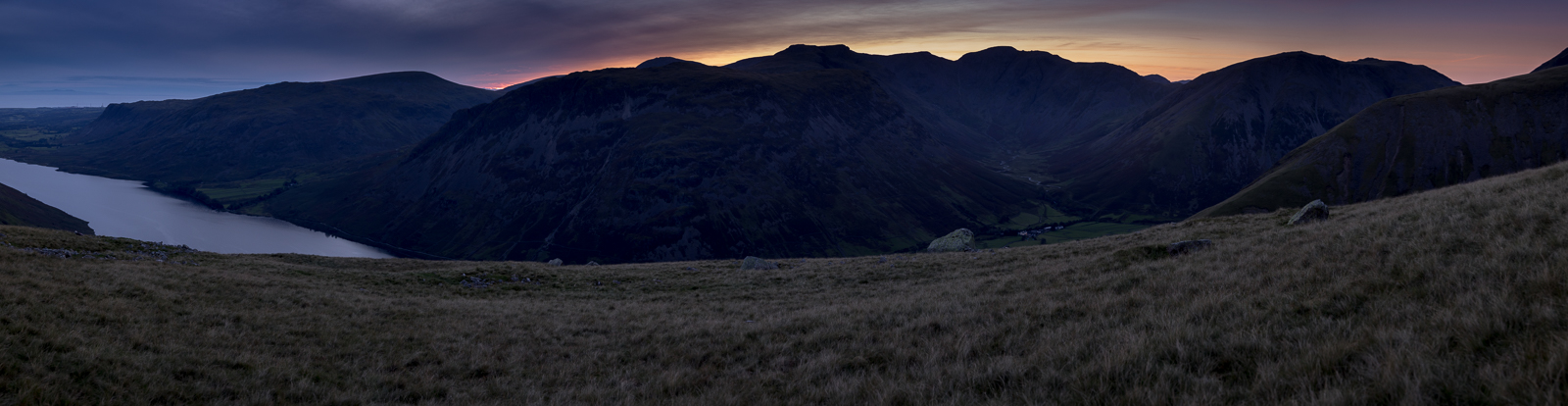
| 7.14 Panorama 458 Weatherwise this was the best day of the week. I got up early and walked along the path opposite the cottage at Middle Row for this view of Wasdale Head. |
 |
||
|---|---|---|
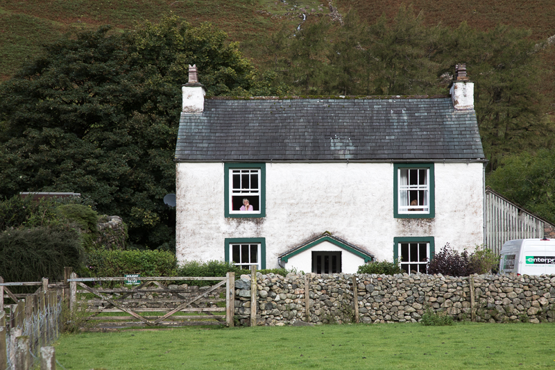
| 9.03 Staying in Wasdale Head meant that it was easy to open our front door and start walking straight after breakfast. The rental van on the right had been hired at short notice after our car died in Pembrokeshire a few days earlier. We were carrying Kayaks so needed a big replacement quickly. |
 |
||
|---|---|---|
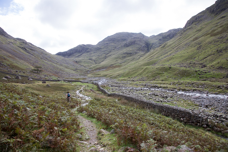
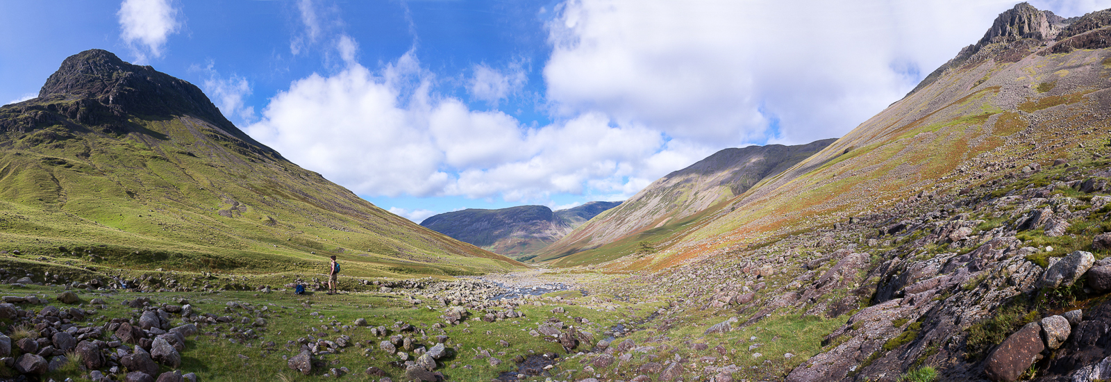
| 9.36 Having passed through Burnthwaite farm we walked up Lingmell Beck. In the top left corner of the picture is the path up to Styhead Tarn. |
 |
||
|---|---|---|
| 9.36 From the same spot looking back down the valley to Yewbarrow. Burnthwaite is visible. |
 |
||
|---|---|---|
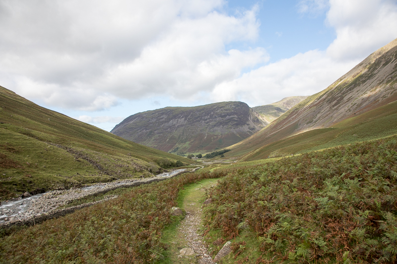
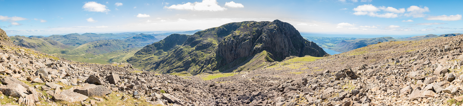
| 9.54 Panorama 459 Underneath Lingmell Crag. Some debate around here about where exactly to cross the beck but we carried on a little further up and found a good spot. |
 |
||
|---|---|---|
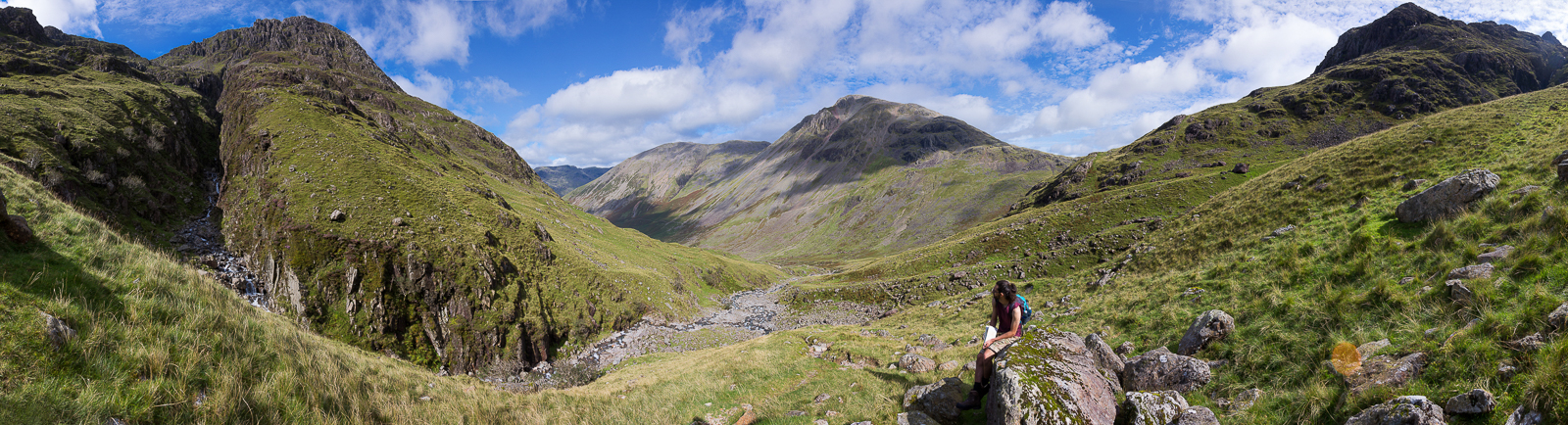
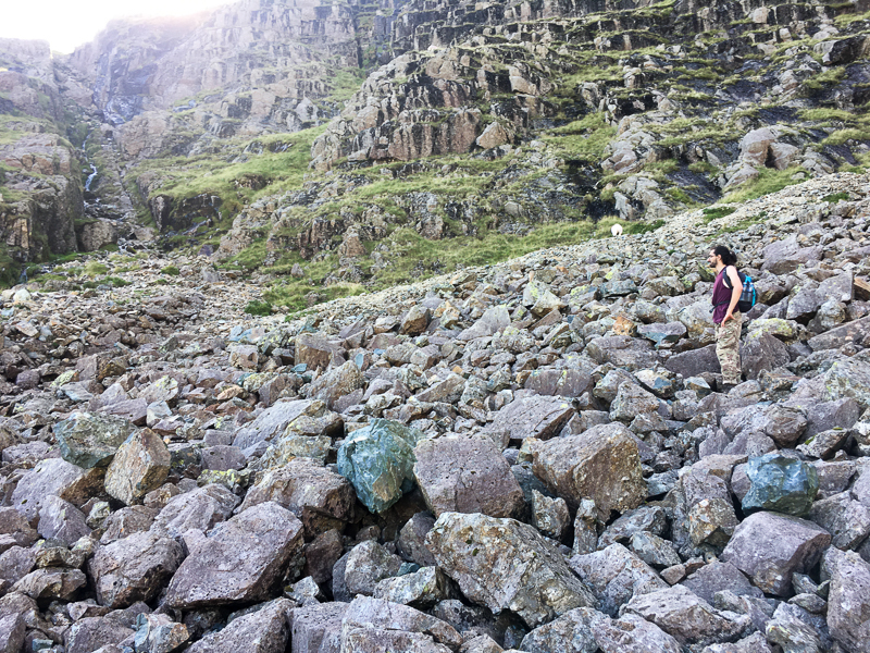
| 10.54 Panorama 460 As we got higher, the crevasses of Piers Gill around us became steeper and more dramatic. In places the path took us close to the edge. Some scrambling was necessary over Middleboot Knotts and assistance (a good shove) for the older members of the party . |
 |
||
|---|---|---|
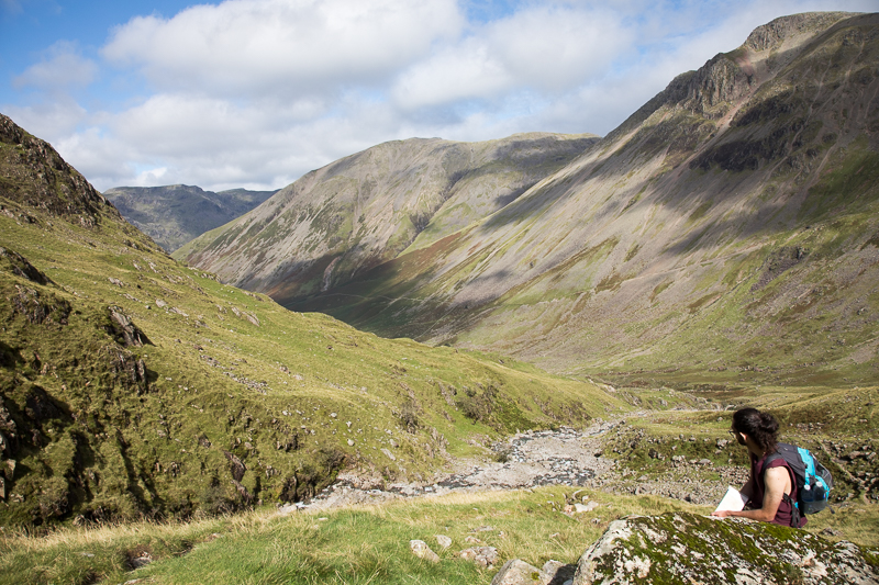
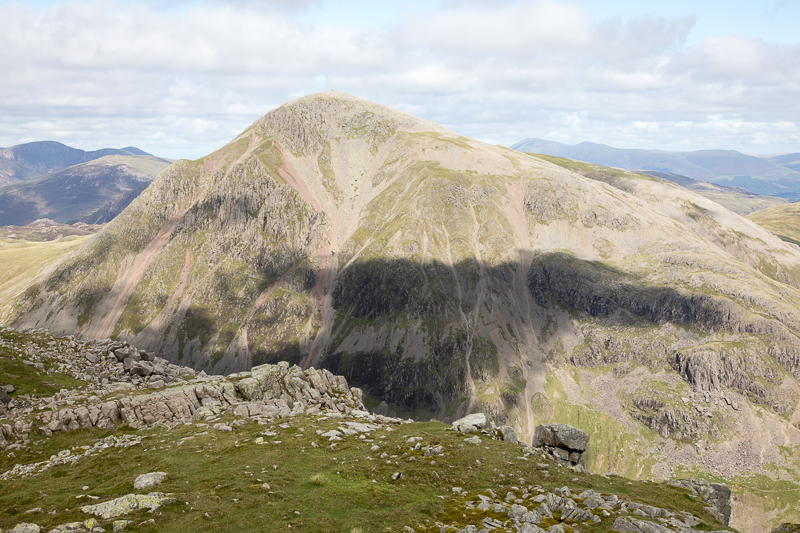
| 10.54 Cloud shadows drifting across Great Gable. |
 |
||
|---|---|---|
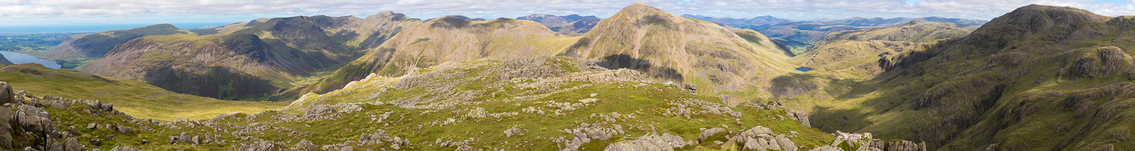
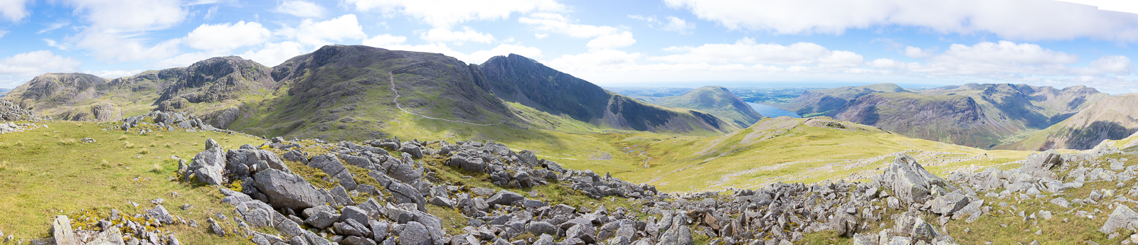
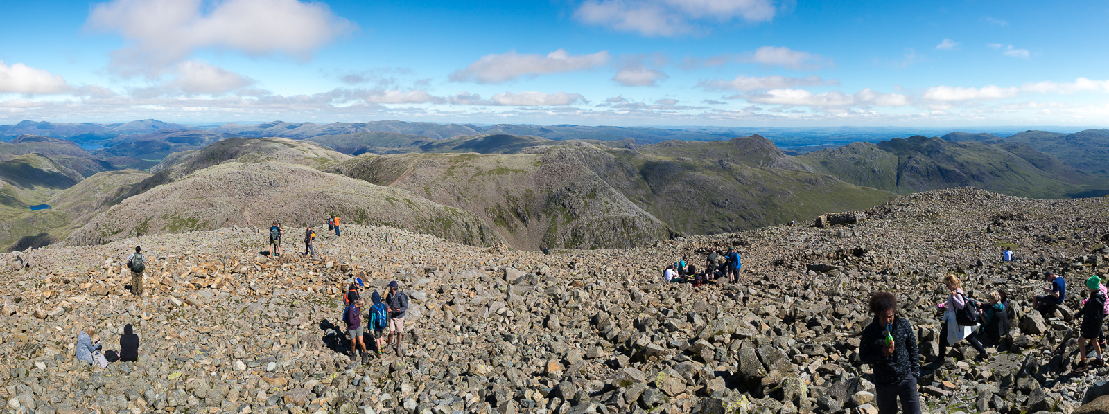
| 12.50 Panorama 461 We eventually joined the corridor route for a short distance before leaving the crowds again to turn right and head towards Lingmell. Super views from the summit on a lovely clear day. |
Two features of the view deserve special mention. |
|||||
Alfred Wainwright - The Western Fells, Lingmell. |
|||||
 |
||
|---|---|---|
| 12.53 The face of Great Gable from the summit of Lingmell |
 |
||
|---|---|---|
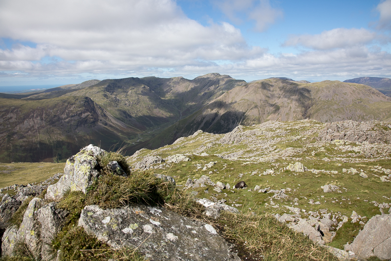
| 13.03 The Pillar group from the summit of Lingmell. Nick and I cannot even mention Pillar without thinking of that day two years ago. |
 |
||
|---|---|---|
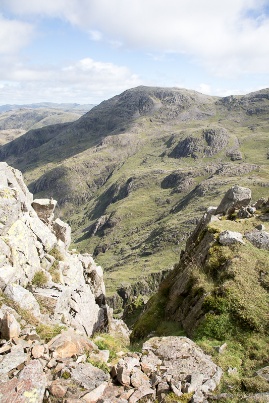
| 13.09 Looking down this gulley into Piers Gill we can make out the path we have just come up on the far side. Great End in the background. |
 |
||
|---|---|---|
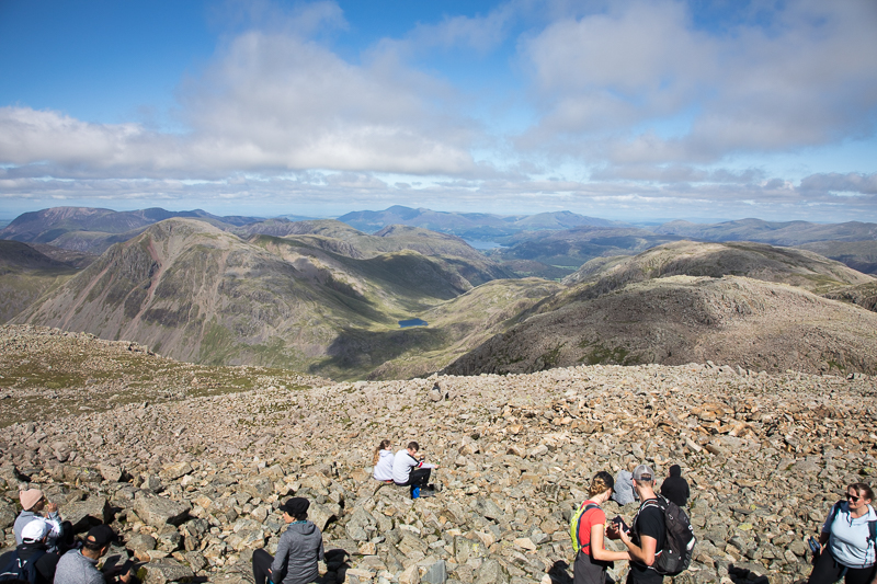
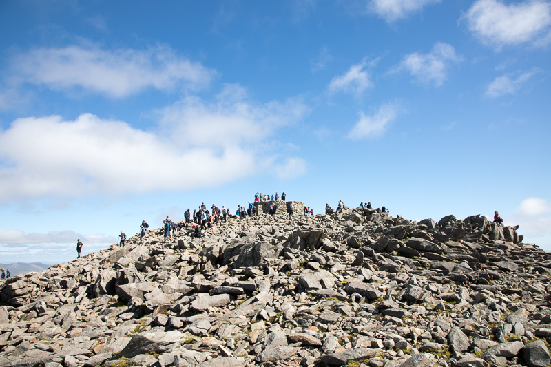
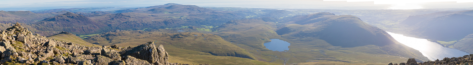
| 13.14 Panorama 462 Looking towards Scafell Pike from Lingmell we could see (and hear) the huge crowds making their way up the tourist route. We had seen 4 people on Lingmell as we approached and a couple after we left but when we were on the summit we were quite alone. |
 |
||
|---|---|---|
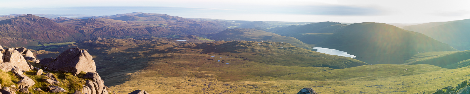
| 14.13 After rejoining the crowds for the last bit of the path we reached the top of Scafell Pike just after 2pm. This side looks over the corridor route that we took last time. Perfect weather today - last time the top few hundred feet were in cloud. In the centre of the picture is Styhead Tarn. |
 |
||
|---|---|---|
| 14.13 From the summit looking towards the Pillar range. |
 |
||
|---|---|---|
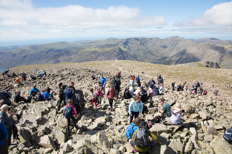
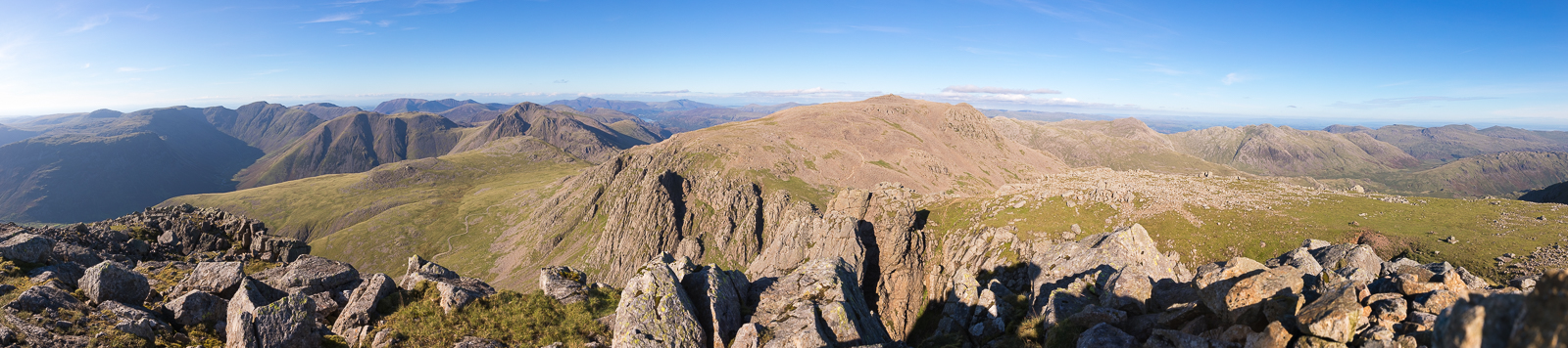
| 14.16 Panorama 463 Any idea that you could stand alone on the summit platform and claim to briefly be the highest person in England was scuppered by the fact that at any one moment there were at least 10 other people trying to do the same thing. Still the new platform makes a good photo point. Looking NE towards Great End, Bowfell and Crinkle Crags with Derwent Water and Windermere visible. |
 |
||
|---|---|---|
| 14.22 Panorama 464 From the summit looking towards Scafell and our next challenge. We could see 3 or 4 people on its summit waving at us. |
 |
||
|---|---|---|
| 14.26 Scafell Pike summit and platform. |
 |
||
|---|---|---|
| 14.28 Panorama 465 From the summit looking west over the main path but we are heading to the south (left) away from the crowds again. |
 |
||
|---|---|---|
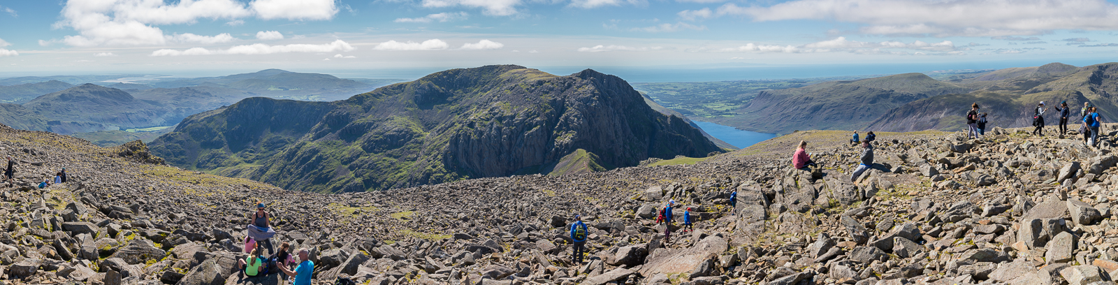
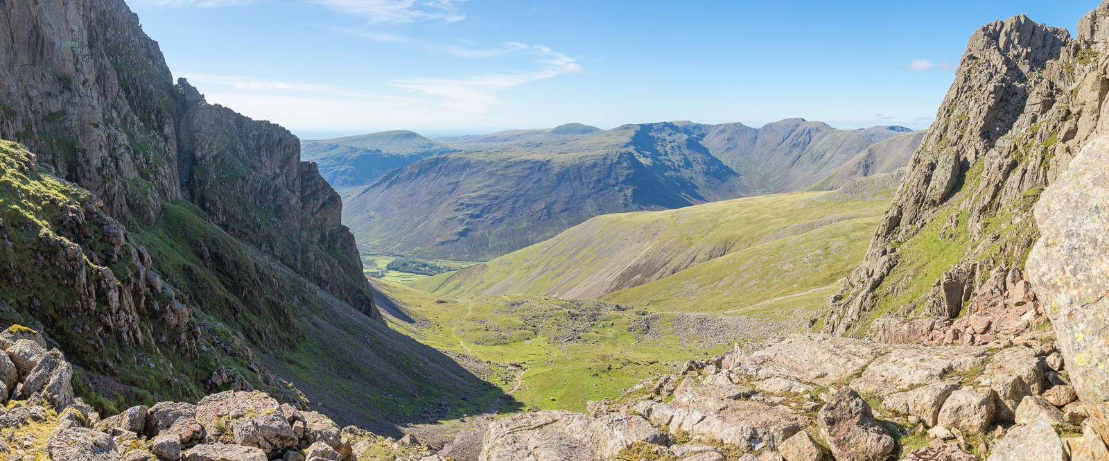
14.46 Panorama 466 We stopped for 2nd lunch with a view over Mickeldore and all the steep faces of Scafell and wondered how on earth we were going to get up it. We also watched two people trying to descend Broad Stand. Click here for a description of the first recorded walk down Broad Stand by the poet Coleridge. |
 |
||
|---|---|---|
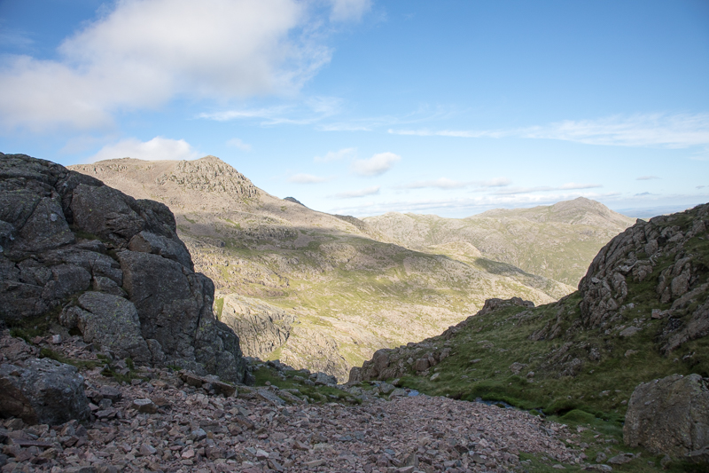
| 15.53 Panorama 467 From Mickledore looking to the west. The cleft of Lord's Rake is visible in the face of the rocks. That is one possible way up Scafell from here. |
 |
||
|---|---|---|
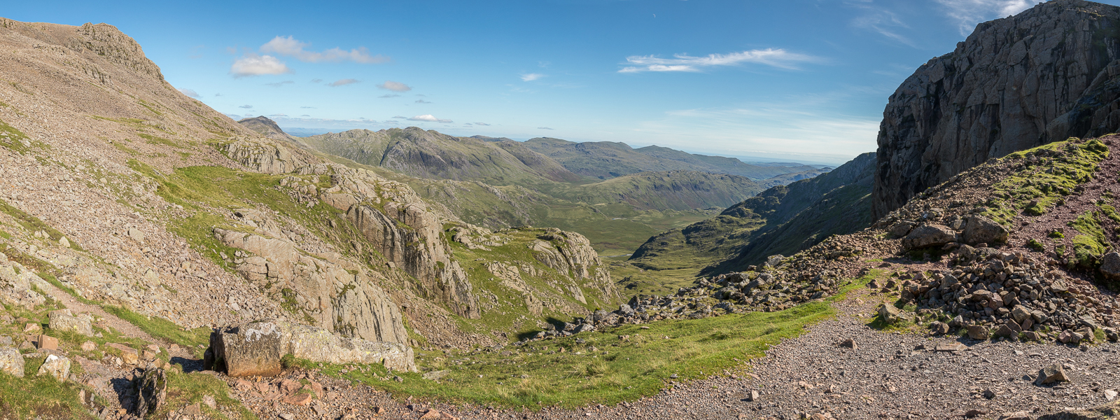
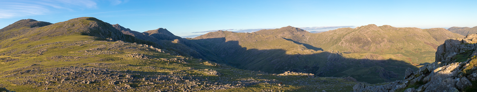
| 15.55 Panorama 468 From Mickledore looking to the east. This was our chosen way - down this valley for 20minutes and then right and up again behind the east buttress, which is the darker face on the right of this picture. Its a big drop and then an ascent of around 800ft in the middle of a long day. |
 |
||
|---|---|---|
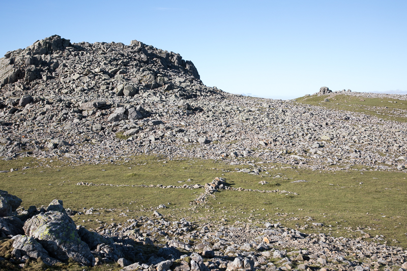
| 16.23 Crossing the rock field below Foxes Rake. The path up to Foxes Tarn is in the top left corner of the picture to the left of the gill. Going up the gill is an option but involves some scrambling. The path is steep but straightforward. |
 |
||
|---|---|---|
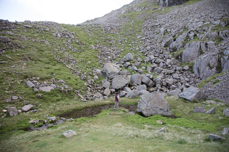
| 17.05 Looking towards Scafell Pike from Foxes Tarn. After a tough haul up the side of the hill we reached the tarn which is the half way point of this bit. The first half was a steep walk up a narrow but solid track. The second half, from here to the top, was a wide loose scree slope with a bit of sliding downwards in places. |
 |
||
|---|---|---|
| 17.05 The actual tarn was a bit of a disappointment. |
 |
||
|---|---|---|
| 17.42 Panorama 469 Finally made it up the scree slopes from Foxes Tarn to Symonds Knott for this view back towards Scafell Pike. |
 |
||
|---|---|---|
| 17.45 Not so many people on Scafell Pike by now. |
 |
||
|---|---|---|
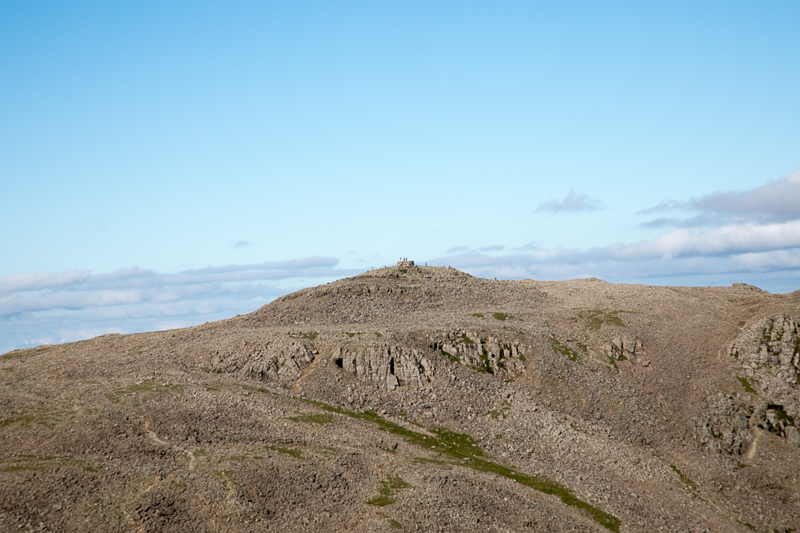
| 17.52 On the saddle behind Symonds Knott is a large cross of stones. From here we turn back away from Symonds Knott and its an easy walk up to the summit of England's second highest mountain - Scafell. |
 |
||
|---|---|---|
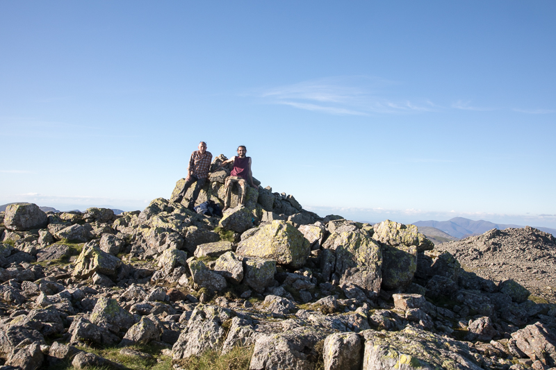
| 18.02 On the summit of Scafell by ourselves. At this point the top of Scafell Pike was empty so in this photo we are the highest people in England. |
 |
||
|---|---|---|
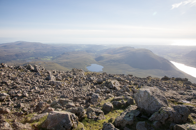
| 18.05 Looking south from Scafell summit with a view of Burnmoor Tarn and Wastwater. |
 |
||
|---|---|---|
| 18.11 Panorama 470 From Scafell summit looking east. |
 |
||
|---|---|---|
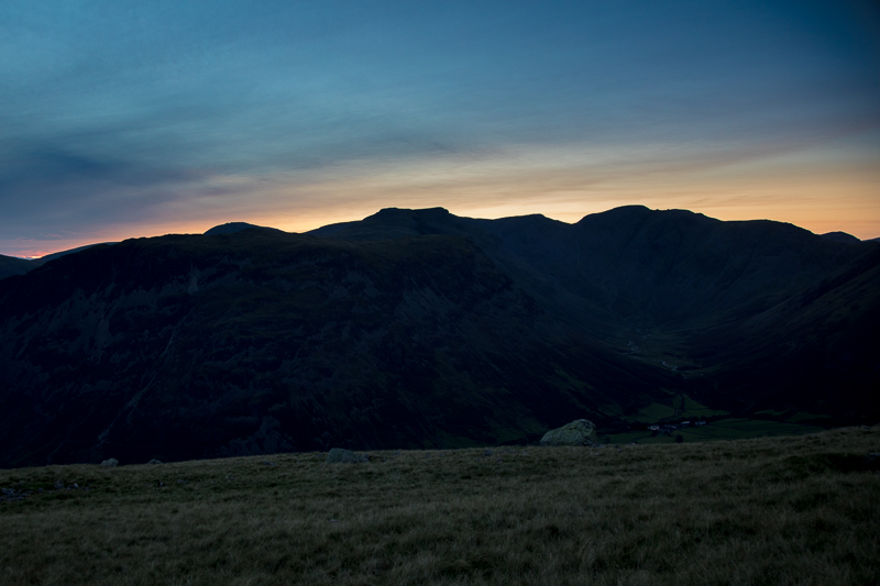
| 18.12 Panorama 471 From Scafell summit looking south. Slight Side is on the left hand side about a mile away - our final summit for the day. It looked like an easy walk but the terrain was very rocky and it took us an hour to reach it. |
 |
||
|---|---|---|
| 19.13 Panorama 472 From Slight Side summit looking back up at Scafell and away to the east. |
 |
||
|---|---|---|
| 19.15 Panorama 473 From Slight Side summit looking south. |
 |
||
|---|---|---|
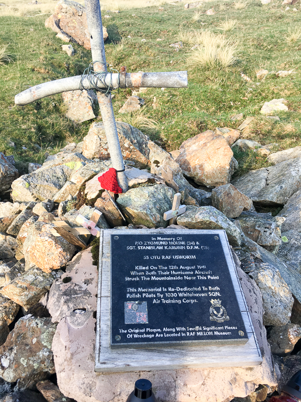
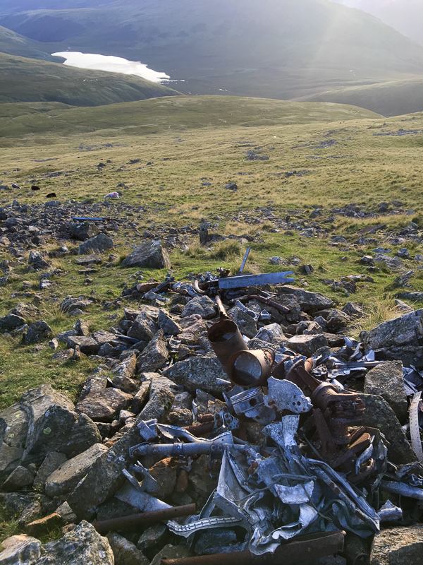
| 19.32 Plaque commemorating the two Polish airmen who crashed into Scafell in 1941. |
 |
||
|---|---|---|
| 19.32 Parts from the wreckage of the two Hurricanes are still there. |
 |
||
|---|---|---|
| 20.28 After an hours walk across the side of Eskdale Fell we could see the lights of the pub in Wasdale Head, next to our cottage. That is still two hours away though. |
 |
||
|---|---|---|
| 20.28 Panorama 474 The sun setting behind the Pillar group with Wastwater and Wasdale Head in view. Compare this picture to the last to understand why I'm addicted to the panoramics. We began a steeper descent of the fell from here, towards the end of Wastwater, and we were soon using torches and testing our night navigation skills as we dropped off the fell. We later found out that the girls could see our lights from the cottage. We eventually got home at 10pm, 13 hours after our start. |
|
|
 |
|---|