| |
|
|
| |
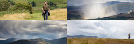
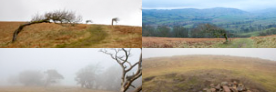
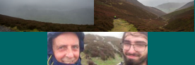
To qualify as easy walks must: 1. Not be excessively long or steep. 2. Have no significant potential dangers eg drops 3. Have no scrambling 4. Usually have no bog areas 5. Have straightforward navigation |
|
| |
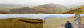
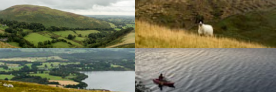
I have sometimes mitigated these factors for example Troutbeck Tongue at 6.9 miles might seem long but a very significant part of the walk, both in and out, is along a flat, quiet country road. |
|
| |
|
|
|
|
|
|
|
|
|
|
|
|
|
|
|
|
| |
|
|
|
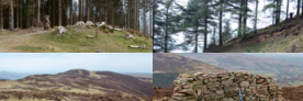
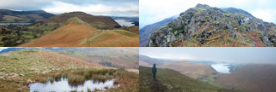
High Doat, Castle Crag (revisit) |
 |
Glaramara Hotel. Seatoller, right through car park and up High Doat. Down and along path to CC. Return along the same path for a short way before turning left and down over Lingy Bank to the river. Past Tongue Gill and along path below Johnny's Wood to Longthwaite. Through Youth Hostel and along river path to Seatoller. |
An alternative route for Castle Crag also taking in the summit of High Doat. A longer but rather more gentle route that avoids the climb up from the river that I did last time (72 below). |
5.04 |
280 |
1375 |
951 |
4 |
|
| |
|
|
|
Hard Knott |
 |
Jubilee Bridge parking. Up to top of pass including walking through Hardknott fort. Left up fell at the cairn then bear left past Border End to HK. Back to road same way then down on the road. Top figures>
NB. To make this walk easy go from the top of the pass. From the road to the summit and back can be done in under and hour as it is only 1.5 miles and 530 ft of ascent. Bottom figures > |
A suprisingly easy walk for a great view of the Lake District's highest fells. I would recommend this walk earlier in the day because the view of the Scafells from the summit is spectacular but later in the day they often fall into shadow.
The difficult part can be getting to the area and parking. There are a very few parking spaces near the top of Hardknott Pass and a few more dotted on the hill on the way up. We started from Jubilee Bridge at the bottom of the hill so that we could take in the Roman Fort on the way up but this makes for a much longer walk and triples the ascent needed. |
|
|
|
1801 |
|
|
| |
|
|
|
Whinlatter Top and Brown How |
 |
Forest centre car park. Up to Gruffalo junction. Sharp left and continue on forest road for 5 mins until a small gate. Go through then immediate right and up the steep hillside for a few minutes. At the top turn left and follow the path along to WT and BH. Reverse route for return. |
A pleasant walk that starts in the forest before a short steepish section to break out onto the fellside and then easy walking along the ridge. If doing all the Wainwrights this is the best one to separate from the other Whinlatter fells if needs be. The rest are more convenient to link together in one walk.
So why two summits? When Wainwright wrote his books the Ordnance Survey said that Brown How was higher so he made it the summit, although he seems sceptical. We now know that Whinlatter Top is 26ft higher. |
|
1046 |
|
|
|
|
| |
|
|
|
Walla Crag, Bleaberry Fell |
 |
Road to Rakefoot at Castlerigg. Along the road, cross the stream at a small footbridge the bear right up the fellside to WC. Across the fell and up to BF summit. Down the NE side of BF off path to Dodd Crag then back across wet ground to rejoin path near WC. |
Very close to Keswick and a short easy walk for a great view plus a cafe at the end.
Note that the route there and back to Walla Crag is easy. (See further notes on the page.) Top figures>
The second part to Bleaberry Fell is a little harder, another hour each way and 3 times the ascent. Also my descent from BF today was experimental, better to reverse the ascent route. Bottom figures > |
|
695 |
|
|
|
|
| |
|
|
|
Sale Fell |
 |
Brumston Bridge. (Same start point as 55.) Up road on east side of sale fell and left up track by the farm. Bear right up to Rivings and on to Lothwaite. Reverse and up SF. Down west side and steeper drop back to road. |
An easy walk up Sale Fell from the east side on good paths or across grass including a stop at the small peak of Rivings and including nice views of Bassenthwaite from Lothwaite. |
|
508 |
|
|
|
|
| |
|
|
|
Ling Fell |
 |
Road on north side. Path circling the north and west side. |
I redid this one because I had a little free time and wanted to get a panorama from the top in better weather. This time I started closer and took an easier route up which was less steep but a little longer. |
2.4 |
619 |
661 |
1224 |
1.2 |
|
| |
|
|
|
Binsey |
 |
Roadside east of fell near Binsey Cottage. Through gate and straight up obvious path. |
An easy walk on grass. A cairn, a trig point and a large shelter at the summit. Good views in all directions especially of the nearby Skiddaw range. On a clear day you can see Scafell Pike and also look right through the Lake District and see the Old Man of Coniston in the far south. |
1.8 |
876 |
603 |
1467 |
1 |
|
| |
|
|
|
High Pike, Carrock Fell |
 |
Roadside near Calebreck. Up path around West Fell to HP. Around and across ridge to CF. Down fellside and across river. |
A gentle walk in a quiet area of the lakes. It takes the less arduous route up by going to High Pike first and then loops around on almost level ground to reach Carrock Fell. There is a steep way up Carrock Fell - this isn't it. Finally a fairly gentle walk down the fell side and across a stream to return to the road. |
5.7 |
968 |
1622 |
2165 |
4.5 |
|
| |
|
|
|
Great Calva |
 |
Road west of Mosedale. Along path at bottom of valley and up fenceline. Reverse for return. |
Once you have driven along the road and parked you've done the hard part of this walk. A flat walk along above the river for an hour and then a short pull up to the summit. A quiet walk in the empty north east. |
5.7 |
975 |
1341 |
2264 |
3 |
|
| |
|
|
|
Black Fell |
 |
Tarn Howes car park. Around lake on NE side. Left and up fell at far end. Return by SW side. |
This is a lovely little walk with lots of variety around a lake, through a wooded area and over a little open fell. Lovely views over the lake from the east side on the return. Nothing steep anywhere. |
4.4 |
614 |
786 |
1040 |
2.5 |
|
| |
|
|
|
Great Mell Fell |
 |
Road opposite Brownrigg Farm. Up path to gate then right and up fell. Same route as first visit. |
This walk has a slightly steeper part as you hit the open fell but soon levels out and the short section through the windswept wood is interesting. Great views all around from the top. |
2.1 |
849 |
919 |
1762 |
1 |
|
| |
|
|
|
Silver How |
 |
Grasmere. Up north side near Allan Bank. Down east side to join road at Wray Gill. |
A lovely walk from Grasmere town with picture postcard Lake District views and never too far from a tea shop. |
2.8 |
223 |
1100 |
1293 |
2 |
|
| |
|
|
|
Castle Crag |
 |
Rosthwaite. Along river to new bridge. Up fell and slate spoil path. Down and along the old Grange Rd a short way then left and down over Lingy Bank. |
Very pleasant along the river through Borrowdale but then steeper and the short climb up the slate hill will be slightly nerve wracking for some. |
2.7 |
276 |
773 |
951 |
2 |
|
| |
|
|
|
Lonscale Fell |
 |
Gale Rd Car Park. Up Skiddaw path and right where the fells meet. Same route back. |
The path up towards Skiddaw is a bit dull unless you regularly turn around and admire the view, but after you turn right and head for Lonscale it becomes very easy. You can also visit the distinctive little bump of Lonscale Pike, just a few minutes east of the summit. |
4.0 |
975 |
1490 |
2346 |
3 |
|
| |
|
|
|
|
| |
|
|
|
Great Mell Fell |
 |
Road opposite Brownrigg Farm. Up path to gate then right and up fell. Same route as first visit. |
This walk has a slightly steeper part as you hit the open fell but soon gets easier and the short section through the windswept wood is interesting. Great distant views all around from the top if it is clear. |
2.1 |
849 |
919 |
1762 |
1 |
|
| |
|
|
|
Wansfell |
 |
Ambleside centre. Up road past Stock Force Gill then up onto fell side to Wansfell Pike. Along ridge to Baystones and back. Down front of fell and back to road through Skellghyl Wood (or return the way you came up.) |
An easy start from the centre of Ambleside and within an hour or so you are looking over the town and Windermere lake from the terrific viewpoint of Wansfell Pike. Unfortunately the Wainwright summit, Baystones, is visible about a mile to the north-east over undulating ground so its a there and back and not such a good view from there either. |
5.6 |
158 |
1948 |
1842 |
5 |
|
| |
|
|
|
Outerside, Barrow |
 |
Parking near Uzzicar farm. Path along gill then right at top to O. Carefully down front to Stile End then up B. Reverse back down to main path. |
A pleasant walk up through the valley on a good path above the river. You can branch off and do each summit separately or take a rather smaller path directly between the two crossing near the smaller summit of Stile End. A slightly different route to our first visit. Another easy way of doing these two is to take the path from Braithwaite to Barrow Door. This is the first part of walk 42r. |
4.6 |
408 |
1842 |
1864 |
3 |
|
| |
|
|
|
Gowbarrow Fell |
 |
Dockray. Over bridge to track between houses then up W fell side. Down same route. |
A fairly easy meander up and back. Many people extend the walk to include nearby Aira Force. |
2.3 |
877 |
802 |
1578 |
1.5 |
|
| |
|
|
|
Ling Fell |
 |
Brumston Bridge. Up road to track then straight up NE fell side. Down E side and around to north to rejoin road. |
The starting point sits between Ling Fell and Sale Fell so you could easily do both. We took a steeper direct route up Ling Fell and a gentler descent. |
1.5 |
498 |
731 |
1224 |
1 |
|
| |
|
|
|
Dodd |
 |
Dodd Wood Car Park. Up forest road north of Skill Beck and around to east of summit. Return via forest path to west of summit and south of Skill Beck. |
An unusual walk in that the first half of it is amongst the trees of Dodd Wood before you break out onto the fell side and at the same time come across spectacular views to the south over Keswick and Derwentwater. The return also re-enters the trees but its almost all on clear mountain roads. Good car park and facilities. |
3.5 |
388 |
1409 |
1647 |
2.5 |
|
| |
|
|
|
Raven Crag |
 |
Roadside NW of Thirlmere. Up track then up forest road. Left off road to The Benn. Down to fence, right then left up to RC. Same route down. Although its not far, it is possible to get a little lost on this walk - some navigation care needed. |
Take the direct route up through the trees on a small and easily missed turn off the main path, or follow the main path to The Benn, as I did. Then ascend the back of Raven Crag. Either way there is a glorious reveal of Thirlmere at the end - see video in the walk notes. |
1.7 |
619 |
1179 |
1512 |
2.5 |
|
| |
|
|
|
Troutbeck Tongue |
 |
A592 layby north of the entrance to Limefit Caravan Park. Up road then right down path to Ings Lane. Along lane, over field and right around TT. Up path to the end. Left up angled path then left up length of TT. Left and down steep front including false summit. |
Quite a long walk in to a small fell but pleasant rural views in the valley. The fell itself is wedge shaped (like a doorstop) with the steep end closest and the gentle slope furthest away. We went up the gentle slope but even the steeper side at the south end is not that severe. |
6.9 |
419 |
1181 |
1194 |
4 |
|
| |
|
|
|
Sale Fell |
 |
Road near Riggs House. Up west side and down east side. |
A very simple little walk around the base of the fell and then up to the rolling summit. Note my comments about Ling Fell above. If you want to do both this is not the best starting point - use the Ling Fell (walk 55) start instead. |
2 |
446 |
760 |
1178 |
1 |
|
| |
|
|
|
Loughrigg Fell |
 |
Ambleside. Through park, over river and up east side from Brow Head Farm. Down north side to Rydal Cave. Back around fell to the west of River Rothay. |
A short and simple climb up but then the large multi peaked top is criss-crossed by many paths and views in all directions. Route can be shortened by returning the way you came up. |
5.5 |
142 |
1497 |
1099 |
3 |
|
| |
|
|
|
Little Mell Fell |
 |
The Hause. Through a gate by the road then straight up the side of the fell. |
A short and steep haul from the road straight up the side to the summit. We lengthened the return by spiralling around the fell a bit on the return. |
1 |
1249 |
437 |
1657 |
1 |
|
| |
|
|
|
Holme Fell |
 |
Road near Tiberthwaite cottages. Through Low Coppice and across road. Up west side and down north side. |
A little navigation needed from the road before the fell starts proper. A rather complex hillside below the summit and plenty of opportunities for us to lose each other albeit briefly. |
2.1 |
479 |
808 |
1040 |
2.5 |
|
| |
|
|
|
Barrow, Outerside |
 |
Road from Braithwaite to Newlands Hause. Path along south side of B the turn right and up to summit. Back down and continue up path to O. Return same way. |
A pleasant walk up through the valley on a good path above the river. You can branch off and do each summit separately or take a rather smaller track between the two crossing near the smaller summit of Stile End. This walk is repeated further up the list - 27r for more photos and my preferred route. |
5.2 |
407 |
1840 |
1864 |
2.5 |
|
| |
|
|
|
Rannerdale Knotts |
 |
Buttermere. Up path towards Whiteless pike. Left and along RK ridge to summit. Same route back. |
A strenuous little walk over grass up from the village and then an undulating stroll all along the spine to the summit at the north end and views over Crummock Water. Drop down to the road or back the way you came for the return as we did. |
3.3 |
369 |
1064 |
1165 |
2 |
|
| |
|
|
|
Knott Rigg, Ard Crags |
 |
Newlands Hause car park. Up nose of KR. Along ridge, down and up to AC. Return the same route. |
Starts with a steep little haul from Newlands Hause but then levels off to a large plateau. The walk across to Ard Crags is an easy there and back with a fairly small down and up each way. |
3.4 |
1095 |
1239 |
1906 |
2.5 |
|
| |
|
|
|
Hallin Fell |
 |
St Peters Church. Up eastern side of fell. Down southern side. |
Walk up from the church car park and then sweep right to approach the summit from the north side. Glorious views over Ullswater and then return via the more direct route to the south. |
1.2 |
738 |
532 |
1273 |
1 |
|
| |
|
|
|
High Rigg |
 |
Legburthwaite Inn. Along road and up at Wren Crag. Along ridge to summit. Down to Youth Centre then on road to main road for a lift back to inn. |
High Rigg is a miniature little fell at the top of the Thirlmere valley with great views particularly of Blencathra. A lovely undulating top that could be walked in either direction - or both if you can't get a lift like I did. If you just want the summit tackle it from the north end for a much shorter walk. |
5.7 |
554 |
1256 |
1161 |
4 |
|
| |
|
|
|
Latrigg |
 |
Keswick. Through park and over footbridge over A66. Up side of fell and right up to summit. Down back east of summit and through woods to the other bridge back to town. NB This is the long way to do Latrigg. I haven't done a page about the short way from the car park - its just too short ! |
First time out we walked up Spooneygreen Lane from the centre of Keswick but instead it can be done in 15 mins from the car park behind the fell at the end of Gale Road. Great views over Keswick and as far as Scafell Pike on a clear day. Height gain from the car park is less than 100m. The easiest of any Wainwrights if you start there. |
6 |
266 |
1575 |
1207 |
3 |
|
| |
|
|
|
Catbells |
 |
Field car park at northern end. Straight up nose to summit. Over summit. Left down path to Derwentwater and back along road. |
I've added this walk because it is a popular one to do when starting the Wainwrights as its easily visible from Keswick and has great views. Its a little harder than most here and there is a little scrambling at the top. A nice way to do it is to take a boat from Keswick over Derwentwater. This drops you off close to the starting point and is often easier than trying to park. An easier way to do it is up the back from Little Town which involves no scrambling.
|
3.2 |
389 |
1353 |
1480 |
3 |
|